 CIESIN Thematic Guides
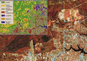
 Classification approaches can be implemented to classify the total scene content into a limited number of major classes. Figure 1 illustrates a classification result of total scene content achieved with Landsat Thematic Mapper data. Classification approaches can also be implemented to distinguish one or more specific classes of terrain (such as water bodies, paved surfaces, irrigated agriculture, forest cutting, or other types of disturbances) within the landscape. The results of such classification can be used to spatially direct the efforts of subsequent digital operations or detailed visual interpretation, or to direct ground data collection efforts. Figure 2 and figure 3 illustrate the use of Landsat Multispectral Scanner data to classify irrigated agriculture in western Nebraska and surface-water features in North Dakota, respectively.

The results of image classification are rarely perfect. Numerous factors affect the classification results, with important ones being the objective of the classification, the spectral and spatial characteristics of the data, the timeframe(s) of the data, the natural variability of terrain conditions in the geographic region, and the digital classification technique employed. Frequently, the classification effort may require preparatory processing prior to classification and the refinement of classes after classification with the use of ancillary data such as terrain elevation and other parameters that influence land cover, its varied conditions, and the disturbances within it. In some cases, it may be useful to merge interpretations derived and digitized from higher resolution satellite data or aerial photography into lower resolution digital image classification results to provide useful detail in areas of concentrated human activity, such as urban regions.
Due to their digital format, the results of digital image classification provide distinct advantages that may make some amount of error tolerable. These advantages allow the results to be 1) readily provided in hardcopy map form; 2) compiled in tabular form to provide area, perimeter, and proximity information (such as edge relationships) for each class; and 3) entered into a geographical information system for subsequent merging and joint analysis with other spatially formatted data.