- Spatial resolution of 1 km
- High radiometric resolution with the following bands:
Blue .43-.47 m
Green .50-.59 m
Red .61-.68 m
Near Infrared .79-.89 m
Mid-Infrared 1.58-1.75 m
 Reproduced, with permission, from:
SPOT Image Corporation. 1993. SPOT System Update. SPOTlight--The SPOT Image Corporation Newsletter (October): 4.
Reproduced, with permission, from:
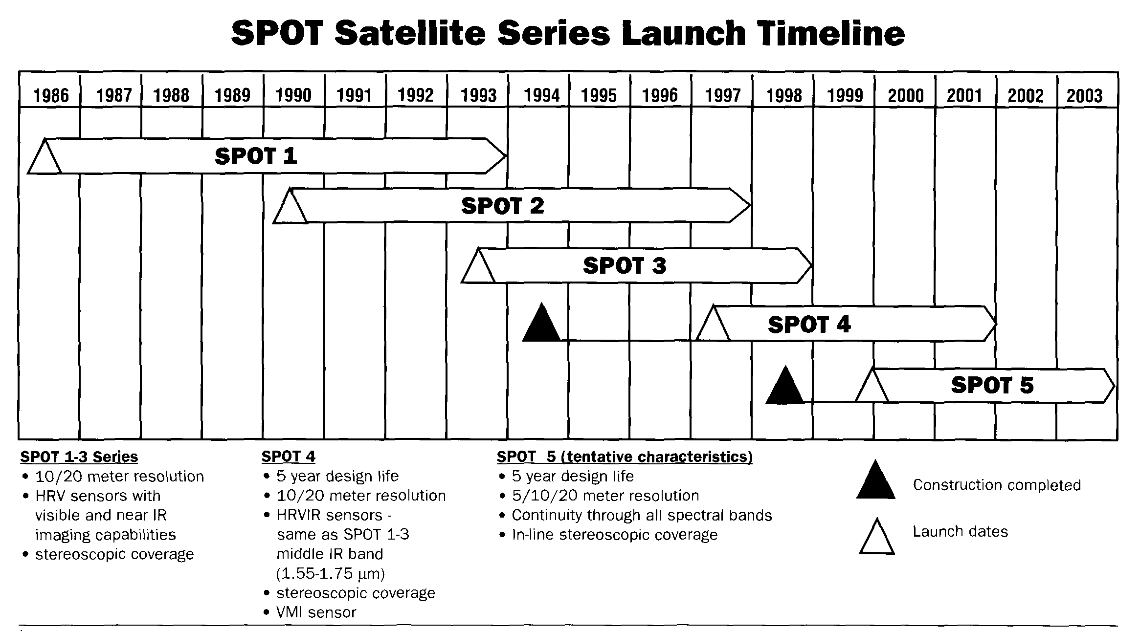
SPOT Image Corporation. 1993. SPOT System Update. SPOTlight--The SPOT Image Corporation Newsletter (October): 4.SPOT 1, launched back in 1986, is still orbiting the Earth and acquiring imagery long past its original two-year design life. It is now dedicated to seasonal data collection for European agricultural monitoring. SPOT 2 has been the primary global data collection platform since early 1990. In over seven years of uninterrupted service, SPOTs 1&2 have recorded almost three million images.
SPOT 3 was successfully launched on September 25, 1993 at 9:45 EDT. Our third satellite is essentially the same as 1&2 in terms of basic design and capabilities. It is equipped with improved positioning instruments and modified onboard tape recorders. Two additional "passengers" on SPOT 3 include:
SPOT 4 is currently being built and is scheduled for launch in 1997. Most notable among its new features will be: The addition of a mid-infrared band (1.58-1.75 um for vegetation studies and geologic application.
Onboard registration of all spectral bands, achieved by replacing the panchromatic sensor (0.51-0.73 um) with Band 2 (0.61-0.68 um) operating in both a 10- and 20-meter resolution mode.
- 2000 km wide swath for daily monitoring of the entire Earth- Spatial resolution of 1 km
- High radiometric resolution with the following bands:
Blue .43-.47
m
Green .50-.59
Red .61-.68
Near Infrared .79-.89
Mid-Infrared 1.58-1.75