|
|
Webinar Features Flood Risk Mapping Tool for the Hudson Valley
|
|
December 21, 2018
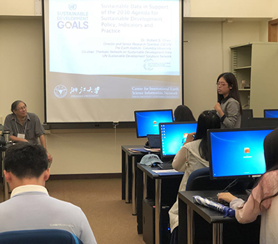
A free, easy-to-use map application that enables users to assess the impacts of flooding due to sea level rise, storm surge and extreme rain events on the lower Hudson River was the subject of a webinar hosted by the New York Energy Research and Development Authority (NYSERDA) December 19. The webinar demonstrated the Hudson River Flood Impact Decision Support System, version 2, which is based on a flood inundation model developed by researchers at the Stevens Institute of Technology in Hoboken, New Jersey. GIS programmer Kytt MacManus presented several use cases and discussed the advantages of incorporating the tool into risk assessment and flood mitigation planning by public officials and resource managers. The decision support system was developed by CIESIN and Stevens with support from NYSERDA.
See: Hudson River Flood Impact Decision Support System, version 2
Webinar recording
|
|
Annual Meeting Draws Earth Science Experts to Washington DC
|
|
December 19, 2018
More than 24,000 Earth scientists and other experts traveled to Washington DC December 9-14 for the annual American Geophysical Union (AGU) fall meeting, held at the Walter E. Washington Convention Center. The meeting provided a unique opportunity to showcase recent developments in research, data, and tools developed by CIESIN and its partners and to network with a diverse community of scientists, policy experts, and practitioners. CIESIN director Robert Chen organized and co-chaired two sessions highlighting innovations in mapping human settlements, population, and infrastructure, and gave three presentations on the integration of socioeconomic and remote sensing data in support of sustainable development research and applications, including a “flash talk” at NASA′s exhibit booth. Senior digital archivist Robert Downs co-chaired sessions in the Earth and Space Science Informatics (ESSI) and Education tracks, and co-authored a number of oral, “e-lightning,” and poster presentations on various data management topics. He also served as a judge for student papers in the ESSI track. GIS programmer Kytt MacManus described CIESIN′s decision support tools for flood and sea level rise planning and presented a poster on the geoprocessing services and Web mapping tools available from the NASA Socioeconomic Data and Applications Center (SEDAC) operated by CIESIN. Associate research scientist Sylwia Trzaska described her work on climate adaptation planning and as leader of a new project under way to map hard-to-reach populations in rural mangrove areas of West Africa. Greg Yetman, associate director for geospatial applications, presented the latest results from CIESIN′s collaboration with Facebook on high resolution population mapping, and contributed to a number of other presentations by CIESIN staff members and partners. The meeting also provided the opportunity for CIESIN to hold an informal side meeting of the POPGRID Data Collective December 14 at the Henley Park Hotel. The meeting brought together more than 20 experts from the Washington DC area to review progress and develop plans for the next phase of POPGRID, which has received additional funding support from the Bill & Melinda Gates Foundation.
See: American Geophysical Union 2018 Fall Meeting
APPENDIX: Fall AGU 2018 Sessions, Papers, and Presentations with CIESIN Staff Participation (226 KB PDF)
|
|
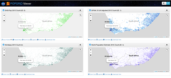
New Tool and Web Site Supports Side-by-Side Comparison of Different Gridded Population Data Sets
|
|
December 4, 2018
CIESIN has released a new Web site and mapping tool designed to help users learn about the growing number of gridded population data sets, and make decisions about which data sets may be the most useful for their needs. The POPGRID web site and viewer were developed under the auspices of the POPGRID Data Collective, an initiative launched by CIESIN in 2017 with support from the Earth Institute, the Bill & Melinda Gates Foundation (BMGF), and the NASA Socioeconomic Data and Applications Center (SEDAC). The POPGRID web site provides users with detailed background information and documentation, as well as direct links to the data and data sources. The POPGRID Viewer incorporates a four-panel display of population count data available from six different data sets: the Gridded Population of the World (GPWv4.10) 2015 count developed by SEDAC; Landscan 2015 developed by Oak Ridge National Laboratory; WorldPop Estimates 2014 from the WorldPop project; Global Human Settlement Population Grid 2015 (GHS-POP) developed by the European Commission’s Joint Research Centre and CIESIN; the Esri World Population Estimate 2016 (WPE); and the High Resolution Settlement Layer (HRSL) developed by the Facebook Connectivity Lab and CIESIN. Users may zoom in on a location of interest anywhere in the world and see the population estimates for four of the six data sets at the same time. A single-panel mode lets users compare national-level metadata across the data sets and draw a polygon or rectangle to obtain an intercomparison table and chart containing customized estimates from all six population data sets (when available). Users of Geographic Information Systems (GIS) may also supply a shapefile to obtain the population estimates for a specific region with a complex shape. Direct comparison of these data sets is important because they are based on different data sources and methodologies that may affect their usability for different purposes. For example, the GPWv4.10 data are based solely on Census data for subnational administrative units, assuming a uniform distribution of population even in large rural districts. Other data sets utilize high-resolution remote sensing data combined with machine-learning algorithms to allocate population to built-up areas. In addition, some data sets use additional inputs such as distance from roads, slope, and other factors to model population distribution at high resolution. The data sets also differ in the time periods covered, the quality and consistency of inputs in different regions, and the demographic characteristics estimated (e.g., age groups). These differences may make the data more useful for some applications, such as assessing potential exposure to extreme events or climate change, but less useful for others, such as estimating the number of vaccines needed in an area of interest. The POPGRID Data Collective was established to bring together and expand the international community of data providers, users, and sponsors concerned with georeferenced data on population, human settlements, and infrastructure. POPGRID seeks to promote cooperation and reduce overlap in producing data, and to encourage trans-disciplinary use and development of data, among other related goals. CIESIN led the initial phase of POPGRID, and is working with the Global Partnership for Sustainable Development Data (GPSDD) and the Thematic Research Network on Data and Statistics (TReNDS) of the United Nations Sustainable Development Solutions Network (UNSDSN) to initiate a second phase of POPGRID with support from BMGF. POPGRID is also contributing to the Group on Earth Observations (GEO) Human Planet Initiative, which aims to improve the quality and accessibility of data needed for assessing humanity’s impact on the planet, access to resources, and exposure to risk.
See: POPGRID Data Collaborative Web site
POPGRID Viewer Mapping Tool
|
|
Recorded Webinars Provide Insight into Settlement Extent Data and Climate-Migration Modeling
|
|
December 3, 2018
Two Webinars led recently by CIESIN staff featured data products distributed by the Socioeconomic Data and Applications Center (SEDAC) managed by CIESIN. The November 14 NASA Earthdata Webinar, “Mapping Global Urbanization from Landsat Data and High-Resolution Reference Data,” was led by Sri Vinay, Information Technology associate director, with scientist Eric Brown de Colstoun from the NASA Goddard Space Flight Center. It featured the SEDAC data sets Global Man-made Impervious Surface (GMIS) and Human Built-up and Settlement Extent (HBASE), along with an associated data visualization and access tool. Nearly 200 individuals participated. For a World Wide Human Geography Data (WWHGD) Working Group Webinar held November 27, Alex de Sherbinin, associate director for Science Applications, gave a presentation on the data and methods behind a recent World Bank report, Groundswell: Preparing for Internal Climate Migration. Several SEDAC data sets were mentioned during the Webinar, including Gridded Population of the World (GPWv4) and Anthropogenic Biomes, as well as Global Population Projection Grids Based on SSPs, v1 (2010 – 2100).
See: NASA Earthdata Webinar, “Mapping Global Urbanization from Landsat Data and High-Resolution Reference Data”
WWHGD Webinar presentation by Alex de Sherbinin (free sign up required)
|
|
Online Seminar Explores the Intersection of Climate, Migration, and Health
|
|
November 19, 2018
The under-explored intersection of climate, migration, and health was the subject of an online “cyberseminar,” hosted November 12–18 by the Population-Environment Research Network (PERN) and sponsored by the International Union for the Scientific Study of Population (IUSSP) and the Population Center at the University of Colorado Boulder (CU-Boulder). Moderators were members of an IUSSP Special Emphasis Panel on Climate, Migration & Health, including Lori Hunter, CU-Boulder; Philippe Bocquier, Université Catholique de Louvain; Sabine Henry, Université de Namur; and Celia McMichael, University of Melbourne. Invited experts presented comments on specific topics: Lori Hunter and Daniel Simon of CU-Boulder on integrating health in the study of migration and climate; Fernando Riosmena of CU-Boulder on migrant health through the lens of climate and migration; Elizabeth Fussell of Brown University on research design; Stefanie Koning of Northwestern University on lessons from the field; William Pan of Duke University on migration as a mediator of climate; and Caroline Zickgraf of the University of Liège on the science-policy interface. PERN Cyberseminars provide a forum for scientists from the social and natural sciences to debate and discuss cutting edge population-environment research topics. CIESIN research scientist Susana Adamo and associate director of Science Applications Alex de Sherbinin are PERN co-coordinators. PERN is a scientific panel of the IUSSP and a sustained partner of Future Earth, an international initiative to advance global sustainability science.
See: PERN Cyberseminar Page
“Climate, Migration, and Health: An Underexplored Intersection” (IUSSP Special Emphasis Panel) (150 KB PDF)
|
|
Powering the Planet Addressed at Fifth Annual Geography 2050 Symposium
|
|
November 19, 2018
Energy will be one of the most important factors influencing geopolitics, environmental quality, transportation routes, conflict, standards of living, food production, technical innovation, and population movement over the next few decades. The annual Geography 2050 Symposium, organized by the American Geographical Society (AGS) in collaboration with the Earth Institute, (EI), brought together more than 400 participants to the Columbia University Morningside campus November 15–16 for a strategic dialogue, “Powering Our Future Planet.″ Keynote speakers included Robert Cardillo, director of the National Geospatial-Intelligence Agency (NGA), and U.S. Senator Sheldon Whitehouse of Rhode Island, who participated remotely due to weather delays. Earth Institute (EI) director Alex Halliday gave welcoming remarks on behalf of the EI, noting the role that CIESIN and the EI Communications team have played in hosting the Symposium for the past five years. CIESIN director Robert Chen moderated a pre-conference panel discussion November 15, with participation by several Symposium speakers and more than 40 Columbia students, faculty, and staff. In conjunction with the Symposium, the AGS organized events at Columbia with high school geography teachers from all 50 states, including a “mapathon” and other activities aimed at helping teachers improve geography education. The teachers had the opportunity to attend the Symposium and also to meet informally with the AGS Council on November 17. Established in 1851, the AGS is the oldest professional geographical organization in the United States. It is dedicated to the advancement of geographical thinking, knowledge, and understanding across business, government, academia, and social sectors and with teachers and students. Chen has served as a member of the AGS Council since 2015 and at the November 17 meeting was re-elected to a second term through 2021. The next Geography 2050 Symposium will again be hosted at Columbia University November 21–22, 2019, with the theme, “Borders and a Borderless World.”
See: Geography 2050: Powering Our Future Planet (2018 Symposium)
Geography 2050: Borders and a Borderless World (2019 Symposium)
|
|
Data Experts Gather in Botswana to Address Digital Frontiers of Global Science
|
|
November 12, 2018
Gaborone, Botswana, drew more than 800 data experts and other participants from 66 countries for International Data Week (IDW), a joint biennial meeting of the Research Data Alliance (RDA), the International Science Council (ISC) Committee on Data (CODATA), and the ISC World Data System (WDS). CIESIN director Robert Chen, associate director for Science Applications Alex de Sherbinin, and senior digital archivist Robert Downs played active roles in the meeting, chairing numerous scientific sessions, presenting seven different talks and three poster papers on a range of data topics, and participating in various side meetings. IDW opened on November 5 with a speech by the President of the Republic of Botswana, His Excellency Dr. Mokgweetsi Eric Keabetswe Masisi, accompanied by remarks from Prof. Ismail Serageldin, founding director of the New Library of Alexandria, and from several senior ministers from Botswana and other African countries. The week included both scientific sessions organized by CODATA and WDS as part of SciDataCon 2018 and working meetings of various RDA interest and working groups, as part of the RDA′s 12th Plenary. A key theme of IDW was the digital frontiers of global science, with a particular focus on the scientific challenges facing Africa and new initiatives such as the African Open Science Platform. In conjunction with IDW, Downs participated in the RDA Technical Advisory Board (TAB) and Chairs Meeting on November 4 and a meeting of the CoreTrustSeal Board on November 8. On November 9, de Sherbinin co-chaired the WDS Data Repositories Day at the University of Botswana, where Downs represented the NASA Socioeconomic Data and Applications Center (SEDAC), a regular member of the WDS. With Martina Stockhause of the World Data Center-Climate (WDC-C), Chen gave an overview of the Intergovernmental Panel on Climate Change (IPCC) Data Distribution Centre (DDC), which CIESIN has co-managed with the WDC-C and the UK Centre for Environmental Data Analysis for more than 20 years. Chen also served as the U.S. delegate to the CODATA General Assembly (GA) November 9–10. The GA approved a new CODATA-WDS task group, Citizen Science for the SDGs—Aligning Citizen Science Outcomes to the United Nations Sustainable Development Goals, to be co-chaired by de Sherbinin. The GA also approved a new Constitution and elected a new President, two Vice Presidents, and eight Ordinary members of the Executive Committee.
See: International Data Week
|
|
Innovative Solar-Thermal Desalination Project Leverages Geospatial Technologies
|
|
November 7, 2018
The United States Department of Energy (DOE) has funded a new project on solar-thermal desalination led by Vasilis Fthenakis, senior research scientist and adjunct professor in the Department of Earth and Environmental Engineering at Columbia University and a pioneer in the field of solar-thermal desalination technologies. Greg Yetman, CIESIN's associate director for Geospatial Applications, is one of the project co-investigators. The project, GIS-Based Graphical User Interface Tools for Analyzing Solar-Thermal Desalination Systems and High-Potential Implementation Regions, will use state-of-the-art solar-thermal desalination models to develop software that supports the planning and valuation of solar-thermal and hybrid technologies. The software will incorporate newly developed geospatial databases of alternative water resources. The project was one of 14 awarded by the DOE′s Solar Desalination funding program that seeks to simplify the planning, design, and valuation of solar thermal and solar hybrid desalination systems in the U.S. and worldwide. CIESIN’s focus will be the integration of spatial data and geographic information system (GIS) functions with the desalination models.
See: Department of Energy announcement
|
|
Leadership Skills Workshop Draws Women in Earth Science to Boulder
|
|
November 2, 2018
CIESIN senior research associate Sandra Baptista joined about 60 participants at the 2018 Earth Science Women’s Network (ESWN) professional development workshop, “Building Leadership Skills for Success in the Scientific Workforce,” held October 28–30 at the University of Colorado Boulder and the Center Green Campus of the University Corporation for Atmospheric Research (UCAR), in Boulder, Colorado. The workshop explored the components of solid leadership and effective communication for management through experiential learning and interactive dialogue. Additional activities included a session led by the American Association of University Women (AAUW) Work Smart on salary negotiation and career counseling, a networking reception with scientists and representatives from regional scientific organizations, and an interactive careers panel with successful senior leaders from academic, private, and public sectors. Baptista is currently co- investigator of the Geo-Referenced Infrastructure and Demographic Data for Development (GRID3) project and co-principal investigator of the Research Translation Core of Columbia University′s Superfund Research Program on Health Effects and Geochemistry of Arsenic, which is supported by the National Institute of Environmental Health Sciences (NIEHS). She has also had lead roles in the NASA Socioeconomic Data and Applications Center (SEDAC) operated by CIESIN and in a range of other projects focused on climate vulnerability and adaptation. Lamont Doherty Earth Observatory (LDEO) colleagues Kirsteen Tinto and Yael Kiro, both associate research scientists, also attended the workshop.
See: Building Leadership Skills for Success in the Scientific Workforce Workshop
Workshop Agenda
|
|
Urban Remote Sensing Data and Applications Highlighted at European Conference
|
|
November 1, 2018
“Mapping Urban Areas from Space 2018,″ organized for a second time by the European Space Agency (ESA), was held at ESA's European Space Research Institute (ESRIN) in Frascati, Italy, October 30–31. The conference provided a venue for scientists and data users alike to share satellite data research results and progress of applications and development. For the opening session on global data products, Greg Yetman, CIESIN associate director for Geospatial Applications, gave a presentation co-authored with Robert Chen, CIESIN director, “Comparing Settlement and Population Data Products; What Do Users Need?″ Yetman also presented a poster on the High Resolution Settlement Layer data collection, describing an ongoing data development activity with the Facebook Connectivity Lab.
|
|
Group on Earth Observations Convenes Fifteenth Plenary in Kyoto
|
|
October 31, 2018
The Group on Earth Observations (GEO) organized “GEO Week 2018” in Kyoto, Japan, in conjunction with its 15th Plenary session, October 31–November 1. The week included two days of side events together with an exhibition held at Kyoto’s International Convention Center. CIESIN director Robert Chen organized a side event of the GEO Data Sharing Working Group (DSWG) and also participated in a session focused on Earth observation applications in support of the Sustainable Development Goals (SDGs). For the DSWG session, he provided an overview of GEO’s longstanding efforts to advance open data sharing since GEO’s establishment in 2005, including the adoption of new data sharing principles in 2015. The DSWG has continued to address a range of implementation issues with regard to open data sharing at both national and international levels. For the SDGs session, Chen reported on efforts by the GEO Human Planet Initiative (HPI) to expand understanding of human settlement, infrastructure, and population patterns and trends over time, drawing on an increasing array of remote sensing and other data sources. In particular, the European Commission’s Joint Research Centre (JRC) has led development of the Atlas of the Human Planet, published in 2016 and 2017; the 2018 edition is due to be released soon, together with data that the NASA Socioeconomic Data and Applications Center (SEDAC) operated by CIESIN helped develop. Chen also gave an overview of other HPI activities, including new resources being developed by the POPGRID Data Collective, an international collaboration supported by the Bill & Melinda Gates Foundation. Chen is a co-chair of the DSWG, representing the International Science Council, and co-leads the HPI with Martino Pesaresi of the JRC.
See: GEO Week 2018
|
|
Latin American Experts Focus on Regional Population-Environment Issues
|
|
October 27, 2018
CIESIN research scientist Susana Adamo attended the 2018 Population Conference of the Latin American Population Association (ALAP) in Puebla, Mexico, October 23–26, where she presented a paper, “Livelihood Diversification and Environmental Change in Argentina’s Drylands.” With Landy Sanchez, professor and researcher at the College of Mexico (Colmex) and chair of the Steering Committee of the Population-Environment Research Network (PERN), she co-organized a workshop on socioeconomic and remote sensing data integration, sponsored by PERN and ALAP’s Environment Working Group. Adamo, a co-cordinator of PERN, was also a speaker at the Plenary session, “Challenges in Monitoring the SDGs: a Regional Dialogue on Demographic Data and Indicators,” jointly organized by ALAP and IUSSP (International Union for the Scientific Study of Population), where she presented “Remote Sensing Data for Monitoring SDGs Environmental Indicators in Latin America and the Caribbean.″
See: ALAP Conference official video (1:03–01:08—workshop, featuring Landy Sanchez; 08:34—Susana Adamo at the Plenary)
|
|
New Visitor and Interns Arrive at CIESIN
|
|
October 26, 2018
CIESIN welcomes Sheng (Sarah) Miao from East China Normal University in Shanghai, who is starting a one-year visit focused on geographic education and evaluation issues related to eco-environment and sustainable development. Miao is a doctoral student in the School of Geographic Sciences who received her bachelor’s in biology from Shanghai Normal University and her master’s in biology education from Guangxi Teachers College. During her stay, she will be working with information scientist Xiaoshi Xing and director Robert Chen. Interning at CIESIN this semester are Camille Stewart and Ambria Benesch. Stewart is working as a part-time Geographic Information System assistant on the new Hudson Valley Wastewater Infrastructure Mapping project, supervised by Dara Mendeloff, the project's co-principal investigator. Currently a student in the Earth Institute’s Sustainability Management program, Stewart has a dual undergraduate degree in geography and biology/anthropology. Benesch is a former summer intern at CIESIN, now working part-time on the Geo-Referenced Infrastructure and Demographic Data for Development (GRID3) project, supervised by senior research associate Paola Kim-Blanco. Benesch is a senior at Barnard College, majoring in environmental policy and political science.
|
|
Second United Nations World Data Forum in Dubai Addresses Sustainable Development Data Challenges
|
|
October 26, 2018
|
|
Source: Photos by IISD/ENB | Kiara Worth
Robert Chen, CIESIN director, far right, served as a panelist for the session, “Earth Observation Applications for the Sustainable Development Goals: Opportunities for Scaling Successful Methods,” at the Second United Nations World Data Forum October 23 in Dubai. The other panelists were (L-R): Argyro Kavvada, Group on Earth Observations (GEO) Earth Observations for the Sustainable Development Goals Initiative; Robert Ndugwa, UN Human Settlements Programme; Jillian Campbell; UN Environment; Enrique Ordaz, National Institute of Statistics and Geography, Mexico; and Marc Paganini, European Space Agency. |
CIESIN director Robert Chen, deputy director Marc Levy, and associate director for Science Applications Alex de Sherbinin joined nearly 2,000 delegates from around the world in Dubai, United Arab Emirates (UAE) October 22–24 for the second United Nations (UN) World Data Forum. The Forum brought together representatives from national statistical offices, UN agencies, development organizations, civil society groups, industry, academia, and other stakeholders to assess critical data challenges in efforts to meet the 2030 Sustainable Development Goals (SDGs) and to collaborate in applying rapidly evolving data science approaches to meet these challenges. Chen co-organized two parallel sessions on population monitoring and geospatial data issues, including one focused on the Geo-Referenced Infrastructure and Demographic Data for Development (GRID3) project for which CIESIN is the coordinating partner. He also discussed the growing use of remote sensing and population data in sustainable development applications in two panels, highlighting new data and services available from CIESIN and other organizations. In a session on data innovation for migration and development interventions, de Sherbinin reported on recent efforts led by the World Bank to model climate-induced migration and displacement. The Forum served as a focal point for a range of complementary meetings and networking opportunities. On October 21, Chen, de Sherbinin, and Levy participated in a pre-meeting of the Global Partnership for Sustainable Development Data (GPSDD), in which CIESIN is an Anchor Partner. Chen remained in Dubai through October 26 to co-chair a meeting of the Thematic Research Network on Data and Statistics (TReNDS) of the UN Sustainable Development Solutions Network (SDSN). TReNDS provides an important avenue for facilitating involvement and knowledge sharing by the global academic community in addressing sustainable development data challenges. Both the Forum and the TReNDS meeting were hosted by the UAE’s Federal Competitiveness and Statistics Agency (FCSA). The First World Data Forum was held in January 2017 in Cape Town, South Africa; the next Forum is expected to be held October 18–21, 2020, in Bern, Switzerland. Summaries of the discussions at the Forums have been provided by the Earth Negotiations Bulletin.
See: Second United Nations World Data Forum
Earth Negotiation Bulletin coverage
Modeling Migration with “Big” Population Data: Groundswell (Alex de Sherbinin presentation Session TA 2.19, 4.082 KB PDF)
|
|
National Statistical and Geospatial Data Experts Convene in Helsinki
|
|
October 19, 2018
|
| CIESIN geographic information specialist Linda Pistolesi at the 2018 EFGS conference, where she described efforts to advance the use and impact of population and infrastructure data in support of the Sustainable Development Goals (SDGs). |
The 11th Annual European Forum for Geography and Statistics (EFGS) was held in Helsinki, Finland, October 16–18, with participation by approximately 200 representatives of national statistical offices and geospatial agencies and other relevant experts from around the world. CIESIN geographic information specialist Linda Pistolesi gave an oral presentation on CIESIN′s efforts to advance the use and impact of population and infrastructure data in support of the Sustainable Development Goals (SDGs) through the formation of the POPGRID Data Collaborative. POPGRID is bringing together the international community of data producers, data users, donors, and other stakeholders interested in fundamental geospatial data on population distribution, human settlements, administrative boundaries, and built infrastructure. Such data are highly dependent on the efforts of national statistical offices and geospatial agencies, who may also benefit from advances in data collection, quality control, data integration, and other methods, such as the use of remote sensing and crowd sourcing. EFGS is an organization that advocates for the integration of geography and statistics, to improve quality, efficiencies, and analysis, and to encourage greater understanding between the statistical and geography communities.
See: European Forum for Geography and Statistics (EFGS)
Abstract
The POPGRID Data Collaborative: Advancing the Use and Impact of Population and Infrastructure Data in Support of the Sustainable Development Goals
|
|
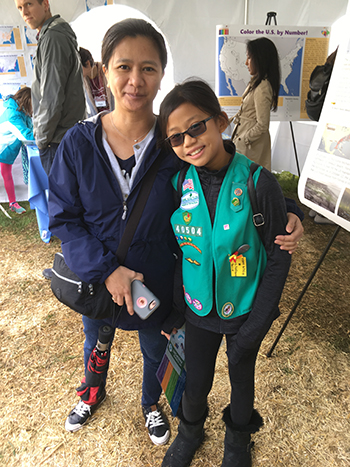
Thousands Learn About Science at Annual Lamont Open House
|
|
October 17, 2018
|
| Lisa Lukang, CIESIN information specialist, with her daughter Isabelle, as they visit the CIESIN tent at the day-long Lamont Open House October 13. |
Despite a cold and rainy start, the day-long Lamont Open House October 13 attracted more than 3,400 people, many of whom visited CIESIN’s tent to learn about the impacts of Hurricane Michael and other hazards and engage with a range of online mapping tools. Several hundred children of all ages participated in a “colorful” interactive map exercise involving a population density map of the U.S. CIESIN staff members demonstrated the Hazards and Population Mapper (HazPop) for mobile phones and tablets, currently available for iOS and under development for Android. Visitors were also able to try out the Hudson River Flood Impact Decision Support System and Adaptmap, a decision support system for Jamaica Bay. A poster highlighted the latest information on people vulnerable to Hurricane Michael, that occurred earlier in the week. Held on the sprawling grounds of Columbia's Lamont Campus in Palisades, New York, the free Lamont Open House has been held nearly every year since 1949 to encourage awareness and interest in the Earth sciences and to emphasize how better understanding of the Earth can help preserve its future. CIESIN has hosted a tent at Open House since moving to the Lamont campus in 1998.
|
|
Visiting Scholars Conclude Research Stays at CIESIN
|
|
October 16, 2018
Two scholars from China have recently completed one-year visits at CIESIN. JiaoJiao Luo, a PhD candidate in the Department of Land Management at Zhejiang University in Hangzhou, worked with information scientist Xiaoshi Xing as a part-time staff associate. Among other activities, she conducted research on land expansion and population growth in the Yangtze River Delta, which resulted in a recent paper in the journal Applied Geography. Lili Zhang, a research scientist with the Computer Network Information Center of the Chinese Academy of Sciences in Beijing, was hosted by CIESIN director Robert Chen and senior digital archivist Robert Downs as a part-time visiting associate research scientist. She focused on open research data sharing policies and practices, assessing current developments around the world to make scientific data more open and accessible, as well as on progress and challenges in China. As part of her visit, Zhang collaborated with Paul Uhlir, chair of the Data Policy Committee (DPC) of the Committee on Data (CODATA) of the International Science Council. She is a member of the DPC and deputy director of the editorial office of China Scientific Data.
|
|
New Data Sets Document Urban Population Change Over Six Millennia and the Recent Human Footprint
|
|
October 15, 2018
Humans have altered the Earth′s land surface over many millennia, with the most dramatic changes coming in recent decades as population has grown, urban areas have spread, and technology and environmental changes have transformed ecosystems worldwide. A unique data set, Historical Urban Population, v1 (3700 BC‒AD 2000), is now available that documents the location and size of urban populations over the past 6,000 years. Developed by Meredith Reba of Yale University, Femke Reitsma of the University of Canterbury in New Zealand, and Karen Seto of Yale, the data set was assembled by digitizing, transcribing, and geocoding historical, archaeological, and census-based urban population records from diverse sources. The data set illuminates long-term urbanization trends and patterns, supporting better understanding of both current and future urbanization trends and associated implications for population, land use and land cover change, and environment. In 2002, the first Human Footprint/Last of the Wild (HF/LOW) data sets, developed by the Wildlife Conservation Society in collaboration with CIESIN, were released through the NASA Socioeconomic Data and Applications Center (SEDAC). Version 1 mapped human influence on the planet′s land surface drawing on spatial data for population, settlements, roads, railroads, agriculture, power infrastructure, and other factors, mostly dating from the early 1990s. The least influenced or “wild” areas in each biome were identfied in the LOW data set. In 2005, version 2 of the data set was released, with more complete and consistent data from about the year 2000. Version 3 of the Human Footprint data sets, providing snapshots of human influence circa 1993 and 2009, is now available through SEDAC. The Human Footprint, 2018 Release (1993) and Human Footprint, 2018 Release (2009) were developed by an international team of scientists led by Oscar Venter of the University of Northern British Columbia. The team included Eric Sanderson of the Wildlife Conservation Society, who led development of the first HF/LOW data sets, and CIESIN deputy director Marc Levy. The new HF data sets are based on a modified methodology and more recent data inputs on built-up environments, population density, electric power infrastructure, crop lands, pasture lands, roads, railways, and navigable waterways. The data are available at a spatial resolution of about 1 kilometer and may be downloaded as a GeoTIFF file or accessed through open online web map services.
See: Historical Urban Population, v1 (3700 BC‒AD2000)
Human Footprint, 2018 Release
|
|
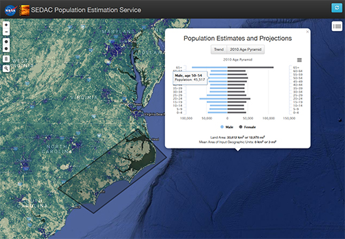
Enhanced Population Mapping Tools Deliver Customized Demographic Estimates
|
|
October 5, 2018
|
| A screen capture from the updated Population Estimator mapping tool for an area along the coast of Wilmington, North Carolina, affected by Hurricane Florence in fall 2018, displays estimates of the distribution of males and females by 5-year age group. The tool accesses data from the Gridded Population of the World version 4 (GPWv4.10) data collection via the Population Estimation Service (PESv3). |
The Population Estimation Service (PES) and associated Population Estimator mapping tool have recently been updated to provide users with the ability to visualize changes in total population over multiple decades together with basic demographic characteristics (age and sex) in the year 2010, for a user-defined geographic region. Version 3 of the Population Estimator enables users to draw a circle or polygon on a world map, which then produces a graph of estimated population for the years 2000, 2005, 2010, and 2015, and a projection to the year 2020. The Population Estimator also provides a “population pyramid” for the year 2010, with estimated population counts by five-year age groups for males and females. Users may save the graphs in selected image formats and download the tabular data for further analysis. These detailed demographic estimates may be highly useful to those interested in assessing how different areas of the world vary in terms of their population growth between 2000 and 2020, and in comparing the relative shape and structure of their population pyramids. The data may be used to estimate important demographic characteristics such as the sex ratio, median age, dependency ratios, and the number of women of child-bearing age. Estimated totals for specific age groups (children under five or the elderly) may be useful as indicators of potential vulnerability to natural, technological, or human health hazards or of the type and level of specific social or health services needed in an area. However, it should be noted that in many parts of the world, censuses have been infrequent, and detailed demographic data at subnational levels are not always available; therefore, population and age-sex data for small subnational areas should be used with caution and the documentation should be consulted. Behind the scenes, the PESv3 draws on the latest version of the Gridded Population of the World data collection (GPWv4.10), which is based on the most current national census data available. Through open web service protocols, any client developer can send queries to the PES to obtain customized estimates for a specified circle or polygon. Links to the service descriptions are available online. Further information is available through SEDAC User Services. PESv3 and the Population Estimator are supported by the NASA Socioeconomic Data and Applications Center (SEDAC), operated by CIESIN as part of the NASA Earth Observing System Data and Information System (EOSDIS).
See: Population Estimation Service overview
Population Estimator Mapping Tool
Gridded Population of the World (GPWv4.10)—What’s New in Revision 10
|
|
U.S. Research Data Alliance Strategizes in Troy
|
|
September 26, 2018
CIESIN director Robert Chen and senior digital archivist Robert Downs joined about 40 research data experts from across the U.S. at the Research Data Alliance–United States (RDA-US) Leadership Meeting in Troy, New York, September 24–25. The annual meeting was led for the first time by Dr. Leslie McIntosh, the new RDA-US executive director, and included participation by RDA′s current secretary-general, Hilary Hanahoe, and former Secretary General Mark Parsons. During the Community Updates portion of the meeting, Downs gave a brief update about the Repository Platforms for Research Data (RPRD) Interest Group (IG), which he co-chairs. The activities and plans of the Legal Interoperability IG, which Chen co-chairs, were also discussed. The meeting addressed RDA strategic initiatives and sustainability, encouraged awareness and coordination across the many different RDA data activities and those of partner organizations, and addressed plans for the RDA 12th Plenary to be held in Gaborone, Botswana, in November as part of International Data Week.
See: Research Data Alliance-U.S.
|
|
Indicator Data for Environmental Performance and Health Updated
|
|
September 24, 2018
The NASA Socioeconomic Data and Applications Center (SEDAC) operated by CIESIN has released updates to two national-level, policy-focused indicator data collections. The 2018 Environmental Performance Index (EPI), produced every two years by a research team from the Yale Center for Environmental Law and Policy and CIESIN, ranks country performance on high-priority environmental issues in two broad policy areas: protection of human health from environmental harm and protection of ecosystems. The 2018 EPI evaluated 180 countries on 24 performance indicators across 10 issue categories covering environmental health and ecosystem vitality. The Natural Resource Protection and Child Health Indicators, 2017 Release (2010 – 2017), is the most recent update to a data set first released in 2010. It was created by CIESIN in support of the U.S. Millennium Challenge Corporation (MCC), which has established selection criteria for the eligibility of countries for foreign assistance. This release includes a consistent time series of Natural Resource Protection (NRPI) scores for 234 countries from 2013 to 2017 and Child Health Indicator (CHI) scores for 199 countries from 2010 to 2017. Both data sets are available for free download from the SEDAC web site. An Earthdata Login, available for free, is required to access the data.
See: The 2018 Environmental Performance Index (EPI)
Natural Resource Protection and Child Health Indicators, 2017 Release (2010 – 2017)
|
|
Urbanization and Its Impacts Topic of September 13 Seminar in New York City
|
|
September 11, 2018
New data on urbanization and the potential implications for cities will be the focus of a seminar held September 13 from 4 to 6 pm at the Population Council in New York City. United Nations (UN) Population Division staff members Francois Pelletier, Sara Hertog, and Danan Gu will give short presentations on the 2018 Revision to the UN′s World Urbanization Prospects, the Population Division′s city boundaries database, and exposure and vulnerability to natural hazards of the world’s major urban areas, respectively. John Wilmoth of the Population Division and Mark Montgomery of the Population Council will then join the presenters for a panel discussion. The seminar is part of an ongoing series, “Population Dynamics and Environmental Change,” organized by CIESIN, the Population Council, the City University of New York (CUNY) Institute for Demographic Research (CIDR), and the UN Population Division. The free seminars aim to promote exchange and dialogue on interdisciplinary research concerning population dynamics in the context of rapid environmental and societal change. To attend, please register here.
|
|
Environmental Diplomacy Summer School in Belgium Tackles Environment and Migration
|
|
September 10, 2018
Environmental changes and migration was the theme of the 2018 Environmental Diplomacy and Geopolitics (EDGE) Summer School, hosted by the Hugo Observatory at the University of Liège in Belgium September 4–8. The event included a keynote address, lectures and presentations, roundtable discussions, and workshop groups, aimed at an audience of approximately 30 PhD candidates from around the world who are studying different aspects of environmental migration and displacement. In his role as EDGE Chair for Environmental Diplomacy for 2018, Alex de Sherbinin, CIESIN associate director for Science Applications, gave the lecture, “Approaches to Modelling Climate-Change Induced Displacement and Migration.” EDGE is a joint project led by three European partners: Sciences Po in France, the University of Economics in Bratislava, and the University of Liège in Belgium, with support from the European Union's Horizon 2020 Framework Programme for Research and Innovation. This was the last of three EDGE summer schools, which had previously been held in Paris in 2016 and Bratislava in 2017.
See: 2018 Environmental Diplomacy and Geopolitics (EDGE) Summer School
Agenda
|
|
How to Measure the Value of Data and Services Discussed in Webinar
|
|
September 9, 2018
As part of the webinar, “Measuring and Assessing Socioeconomic Value,” sponsored by the Earth Science Information Partners (ESIP) September 4, CIESIN senior digital archivist Robert Downs described how the NASA Socioeconomic Data and Applications Center (SEDAC) has used citation analysis to improve understanding of the scientific impact of its data products and services. SEDAC has developed a searchable Citations Database containing more than 4,000 citations of SEDAC data and information resources from the past two decades, primarily in peer-reviewed journal articles and books. This database of known citations serves as the basis for developing better metrics of the extent, type, and degree of use of SEDAC′s data across diverse scientific disciplines and application areas, including their integration with remote sensing data. SEDAC is one of the Distributed Active Archive Centers (DAACs) in the NASA Earth Observing System Data and Information System (EOSDIS) and has been operated by CIESIN at Columbia University since 1998. The webinar was organized by Arika Virapongse of Middle Path EcoSolutions; Erin Robinson of ESIP; and Françoise Pearlman and Jay Pearlman of FourBridges. Robinson gave the introduction and closing remarks, and Jay Pearlman served as moderator. Other presenters included Yusuke Kuwayama of Resources for the Future and Miriam Murambadoro, researcher at the Council for Scientific and Industrial Research in South Africa. Available online, the webinar is the third in a six-part series on the socioeconomic value of earth science data, information, and applications.
See: About the Webinar Series
|
|
Zurich Workshop Examines Migration-Environment Linkages
|
|
September 8, 2018
CIESIN research scientist Susana Adamo joined a select group of researchers from Europe and the U.S. at the International Workshop on Migration and the Environment, held September 3–4 at the Swiss Federal Institute of Technology Zurich (ETH-Zurich) in Zurich, Switzerland. At the workshop, she gave an overview of current issues relating to data relating to migration/displacement and the environment, with examples and a discussion of the role of data integration. Her presentation, “An Assessment of Data Issues in Environmental Migration Research,” was co-authored with Alex de Sherbinin, associate director for Science Applications; Emilie Schnarr, staff associate; and Tiago Nascimento, visiting scholar. The workshop was organized by the Center of Economic Research at ETH Zurich.
See: Workshop Program
|
|
Spatial Heterogeneity in Health and Hazards Research Focus of New Visiting Scholar
|
|
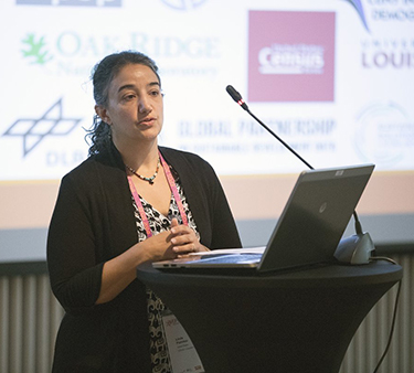
September 7, 2018
|
| Prof. Sophie Vanwambeke of the Department of Geography at the Université catholique de Louvain in Belgium is visiting CIESIN until May 2019. |
Prof. Sophie Vanwambeke of the Department of Geography at the Université catholique de Louvain in Belgium has recently arrived at CIESIN for a visit until May 2019. She will work with CIESIN geospatial experts and with Maria Diuk-Wasser of the Columbia University Ecology, Evolution, and Environmental Biology (E3B) Department on issues related to integrating spatially heterogeneous data on population, vector-borne disease, and natural hazards to better understand exposure, vulnerability, and risk. At the Université catholique de Louvain, Prof. Vanwambeke is affiliated with the Earth and Life Institute and with the Centre for Research on the Epidemiology of Disasters (CRED). She received her master’s and PhD in geography from the Université.
See: Sophie Vanwambeke Web site
|
|
New Award to Support Flood Resilience Planning in the Hudson River Valley
|
|
September 5, 2018
CIESIN has been given an award by the New York State Water Resources Institute at Cornell University to conduct a pilot project to assist communities in mapping wastewater infrastructure and create data for use in flood resilience planning. Greg Yetman, CIESIN associate director, is the principal investigator with Dara Mendeloff, geographic information specialist, as co-principal investigator. They will collaborate with Kristin Marcell of the NYS Department of Environmental Conservation (DEC) Hudson River Estuary Program (HREP). The Estuary Program has been working with communities in the Hudson Valley to help them understand flooding risk in their communities, identify vulnerable assets, and develop and implement actions to increase flood resilience.
|
|
Geospatial Applications in West Africa Addressed in Training Workshop
|
|
August 24, 2018
|
| Greg Yetman, associate director for Geospatial Applications, led a two-day training workshop August 14–15 for partners in the West Africa hub of the SERVIR project, a joint venture between NASA and the U.S. Agency for International Development. The workshop included attendees from Ghana, Mali, Nigeria, and Niger. |
Greg Yetman, CIESIN associate director for Geospatial Applications, led a two-day geographic information system (GIS) training workshop August 14–15 in Niamey, Niger, for partners in the West Africa hub of the SERVIR project. Attendees from Ghana, Mali, Nigeria, and Niger learned about applications of GIS technologies to studies in hydrology, desertification, and environmental change in tropical forests and rangelands. SERVIR, a joint venture between NASA and the U.S. Agency for International Development, provides satellite-based Earth monitoring data, geospatial information, and tools to help improve environmental decision-making in developing countries. CIESIN and the International Research Institute for Climate and Society (IRI) are contributing to the development of applications of NASA data products to support regional decision-making and are conducting technical training for regional partners. CIESIN and IRI are subcontractors to Tetra Tech/ARD, who manages the West Africa hub for USAID and NASA.
|
|
Summer Mentoring Programs Encourage Field Research by High School Students
|
|
August 15, 2018
|
| CIESIN geographic information specialist Dara Mendeloff (left) with interns Gloria Cadle (center) and Roheyatou Ceesay at an August 14 presentation of the students′ research, held at the Lamont campus of Columbia University. A third student, Jacques Pelman, is not pictured. Mendeloff mentored the three students as part of the Wave Hill Woodland Ecology Resarch Mentorship (WERM) program for New York City science students. |
New York City students Roheyatou Ceesay, Gloria Cadle, and Jacques Pelman presented the results of their summer field work in a poster session at the Lamont campus August 14 as part of the Secondary School Field Research Program (SSFRP) organized by the Lamont-Doherty Earth Observatory (LDEO). Their research project, “Spatial Analysis of Socio-Environmental Vulnerabilities and Stewardship Groups,” examined how the actions of stewardship groups affect communities challenged by rapid urbanization and environmental injustice. The three students were mentored by CIESIN geographic information specialist Dara Mendeloff through the Wave Hill Woodland Ecology Research Mentorship (WERM) program. Ceesay is a rising senior at the High School of American Studies at Lehman College; Gloria Cadle is a rising senior at New Visions Charter High School for Advanced Math and Science; and Jacques Pelman is an incoming freshman at Lehigh University majoring in environmental engineering. The 14-month WERM program focuses on the principles of ecology, particularly ecological restoration in New York City, and provides opportunities for students to conduct field work under the guidance of working scientists. Both WERM and SSFRP are part of the NYC Science Research Mentoring Consortium.
See: Wave Hill Woodland Ecology Research Mentorship
LDEO Secondary School Field Research Program
NYC Science Research Mentoring Consortium
|
|
Shanghai′s Chongming Island Subject of International Forum
|
|
August 13, 2018
|
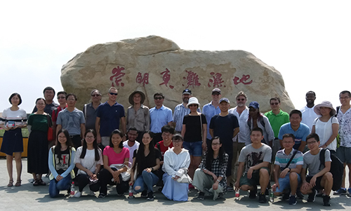
| Scientists from the Earth Institute at Columbia University, the Science and Resilience Institute at Jamaica Bay, and the NASA Goddard Institute for Space Studies join faculty and graduate students of the East China Normal University (ECNU) in a visit to the Chongming Island wetlands near Shanghai, China. The group attended a scientific forum organized by ECNU and Columbia University August 6–8. |
Chongming Island, located in the mouth of the Yangtze River across from Shanghai, China, was both the topic and site of a scientific forum organized by East China Normal University (ECNU) and Columbia University August 6–8. Eight scientists from the Earth Institute at Columbia University attended the forum, together with Adam Parris, executive director of the Science and Resilience Institute at Jamaica Bay (SRI@JB) and Christian Braneon of the NASA Goddard Institute for Space Studies (GISS). More than 15 ECNU faculty members also participated, along with many of their graduate students. Keynote talks on challenges for coastal cities in the face of climate change and population dynamics were given by Prof. Joel Cohen, director of the Laboratory of Populations of the Earth Institute and Rockefeller University, and by Robert Chen, CIESIN director. Other presentations were made by CIESIN scientists Alex de Sherbinin and Xiaoshi Xing and by Lamont-Doherty Earth Observatory (LDEO) deputy director Arthur Lerner-Lam and LDEO scientists Christopher Small, Mingfang Ting, and Beizhan Yan. As part of the forum, the group toured parts of Chongming Island as well as the nearby Qingcaosha Reservoir, a unique freshwater reservoir within the Yangtze River that now supplies more than two-thirds of Shanghai′s tap water. The forum identified a number of areas of promising research collaboration, aimed at improving adaptation in coastal megacities like Shanghai and New York City. While in Shanghai, Chen, Lerner-Lam, Small, Ting, Xing, and Yan also participated in an event hosted by the Columbia Global Centers | Beijing August 5 at Three on the Bund. The event included lunch with Chinese high school students participating in a summer program, “New Frontiers in Earth Science,″ and an afternoon panel discussion showcasing both LDEO and CIESIN research, with a particular focus on collaboration with scientists and organizations in China. The audience included more than 150 Columbia University alumni and affiliates.
|
|
Need for New Geoscience Data Services Examined at Boulder Workshop
|
|
August 10, 2018
Scientists, data managers, and systems professionals gathered at the National Center for Atmospheric Research (NCAR) in Boulder, Colorado, August 7–9 for the Geoscience Digital Data Resource and Repository Service (GeoDaRRS) Workshop. Robert Downs, CIESIN senior digital archivist, was a member of the organizing committee and served as monitor for the August 8 plenary session, “What is Realistic/Doable With Constraints?″ The workhop sought to establish geoscience community expectations and requirements for digital data management support, and in particular to determine if new services are needed to complement existing data facilities funded by the U.S. National Science Foundation (NSF). The workshop was sponsored by NSF, with additional support from Globus Computation Institute, Hewlett Packard Enterprise, and DDN Storage.
|
|
CIESIN Continues SEDAC Operations under New NASA Contract
|
|
August 1, 2018
The NASA Socioeconomic Data and Applications Center (SEDAC), one of 12 Distributed Active Archive Centers (DAACs) in the Earth Observing System Data and Information System (EOSDIS), will continue to be operated by CIESIN from its offices at the Lamont campus of Columbia University for one year and up to four additional option years and 6 additional option months (through January 2024). The new contract took effect on August 1, immediately after the expiration of the previous five-year contract. SEDAC plays a unique role in EOSDIS, supporting the integration of remote sensing data with socioeconomic and other geospatial data to facilitate research, applications, and education. More than 52,000 users are currently registered to download and use SEDAC data, and SEDAC data have been cited in more than 500 new scientific articles each year across many different scientific disciplines. SEDAC data and services are widely used in real-world applications and decision-support systems. Under the new contract, CIESIN director Robert Chen continues as SEDAC′s manager, and Alex de Sherbinin, associate director for Science Applications, remains SEDAC′s deputy manager. Sri Vinay, associate director for Information Technology, will also continue as SEDAC Systems Engineer. Columbia University has operated SEDAC since 1998. CIESIN has received an “Excellent” rating from NASA for its performance in managing the recently completed SEDAC contract. SEDAC is a regular member of the World Data System of the International Science Council (ICSU-WDS) and a Type I member of the Earth Science Information Partners (ESIP).
See: NASA Awards SEDAC DAAC Contract (press release)
|
|
CIESIN Scientist Joining Faculty in Delaware, and Other Departures
|
|
July 31, 2018
Senior research associate Pinki Mondal is leaving CIESIN in August to join the Department of Geography at the University of Delaware as an assistant professor. Mondal conducts research on the sustainability of agricultural systems and the impacts of climate variability on agriculture in South Asia, leveraging remotely-sensed data. While at CIESIN, Mondal led the development of the India Data Collection and the Global Summer Land Surface Temperature (LST) Grids, v1. She also helped develop the Global Urban Heat Island (UHI) Data Set, v1 (2013) and other SEDAC data sets. She was recently featured in a NASA Earthdata User Profile. Prior to joining CIESIN in 2015, Mondal was a postdoctoral researcher with University Professor Ruth deFries in the Department of Ecology, Evolution, and Environmental Biology. She received her PhD in Land Change Science from the University of Florida. Rebeca de Bakker Doctors, a graduate student at École Polytechnique in Paris, has wrapped up a four-month internship working with senior research associate Sandra Baptista and team members from the Geo-referenced Infrastructure and Demographic Data for Development (GRID3) initiative. Her internship was arranged through the Alliance Program, with deputy director Marc Levy serving as her co-supervisor. She shared her work July 23 at a lunchtime presentation, “Measuring the Value of High-Resolution Data in the Implementation of SDGs: A Study Case in Southern Malawi.” She holds a BS in Economics from the Pontifical Catholic University of Rio de Janeiro. Zhen Wu, a graduate student with the School of Geographic Sciences at East China Normal University (ECNU) in Shanghai, has also recently left CIESIN after a six-month training visit. She presented her work, “Impact of Urbanization on Coastal Environmental Changes: A Case Study of Shanghai,” during a July 20 talk at CIESIN. Wu has a BS degree in Geographic Science from Hunan University of Science and Technology.
See: Rebeca de Bakker Doctors presentation abstract
Zhen Wu presentation abstract
|
|
Seminar Held on Environmental Policy and Sustainable Development
|
|
July 27, 2018
|
| CIESIN director Robert Chen, left, listens to a student speak following his presentation at a summer seminar on environmental policy and sustainable development for students from Zhejiang University in Hangzhou, China. The seminar was organized and hosted by CIESIN July 23–27 at the Lamont campus in Palisades, New York. |
CIESIN organized and hosted a summer seminar, “Environmental Policy and Sustainable Development,” July 23–27 at the Lamont campus in Palisades, New York. Fifteen graduate and undergraduate students from Zhejiang University in Hangzhou, China, participated in the seminar, which addressed a range of topics including climate change impacts and adaptation, population dynamics, geospatial methods and data, and sustainability indicators. Presenters included CIESIN director Robert Chen, associate directors Alex de Sherbinin and Greg Yetman, research scientist Susana Adamo, and other CIESIN staff, together with Lamont Associate Research Professor Radley Horton and John Konarski, chief executive officer of the American Geographical Society. The group also met July 27 with Prof. Joel Cohen, director of the joint Earth Institute/Rockefeller University Laboratory of Populations. Most of the seminar participants were students in the School of Public Affairs at Zhejiang University.
|
|
CIESIN Welcomes New Visitors and Interns
|
|
July 23, 2018
CIESIN is pleased to welcome several new visitors and interns this summer. At CIESIN until February 2019, Tiago Nascimento is working with research scientist Susana Adamo to finalize his thesis on spatial mobility of the population in response to the incidence of droughts in Brazil`s Northeast. Currently a doctoral student at CEDEPLAR/Universidade Federal de Minas Gerais-Brazil, Nascimento has a bachelor’s degree in geography and a master’s degree in demography from the PPGDEM/Universidade Federal do Rio Grande do Norte, Brazil. Summer interns Alhousseyni Maiga and Ambria Benesch have joined the Geo-Referenced Infrastructure and Demographic Data for Development (GRID3) project, which supports low- and middle-income countries in developing and utilizing foundational geospatial data to advance development goals. Maiga is currently pursuing a master’s degree in international development policy at the Sanford School of Public Policy at Duke University, under a Rotary Peace Fellowship. He has a BA in English from École Normale Supérieure in Bamako, Mali, and worked for more than a decade as country director in Mali for buildOn, a US-based nongovernmental organization. Benesch is a rising senior at Barnard College, majoring in environmental policy and political science. Also interning at CIESIN for eight weeks is Tiffany Firebaugh, who is working with Susana Adamo and Alex de Sherbinin, associate director for Science Applications, on climate change-induced displacement and migration. Firebaugh holds a BA in International Affairs from Columbia University and is currently pursuing an MPH in Public Health in the department of Population and Family Health, with a certificate in Humanitarian Assistance, at Columbia′s Mailman School of Public Health. Her research focus is climate migration, specifically mass resettlement due to climate change and ensuring the long-term safety and health of populations who are forced to move.
|
|
Socioeconomic Value of Earth Science Data Highlighted at Arizona Meeting
|
|
July 20, 2018
At the 2018 Earth Science Information Partners (ESIP) Summer Meeting in Tucson, Arizona, July 17–20, Robert Downs, senior digital archivist, and John Scialdone, Data Center Services manager, represented the NASA Socioeconomic Data and Applications Center (SEDAC) and contributed actively to the program. Downs gave a number of presentations relevant to the theme of the meeting, “Data for our Changing Earth: Realizing the Socioeconomic Value of Earth Science Data.” He presented “End User Community Readiness Ranking—Augmented Metadata” during the session, “Operational Readiness Levels: Establishing Trusted Data to Improve Situational Awareness” on the first day of the meeting. For the ESIP Educators′ Workshop, “Computing in the Classroom, Coding, Gadgets, and STEM,” held July 18, Downs demonstrated how the SEDAC Map Viewer can be used in the classroom. On July 19, together with Karen Moe, emeritus technology manager at NASA's Goddard Space Flight Center, he presented “What's the Value of Integrating Socioeconomic and Earth Observations Data?” co-authored with CIESIN director Robert Chen, in a session, “Quantifying the Value of EO Data via Socioeconomics.” In the session, “Preparing for the CoreTrustSeal—Insights and Lessons Learned,” Downs presented, “CoreTrustSeal Certification: First-Year Perspectives,” on behalf of the CoreTrustSeal Foundation Standards and Certification Board, of which he is a member. He is also a member of the Assembly of Reviewers of the CoreTrustSeal Foundation, and serves as the ESIP Type 1 Representative on the ESIP Governance Committee.
See: 2018 Summer ESIP Meeting
|
|
NASA Health and Air Quality Experts Convene in Madison
|
|
July 18, 2018
The fourth meeting of the NASA Health and Air Quality Applied Sciences Team (HAQAST4) was held July 16–17 in Madison, Wisconsin. Alex de Sherbinin, associate director for Science Applications, presented a paper and a poster, jointly developed with geographic information specialist Tricia Chai-Onn, on policy-relevant indicators of air quality. The presentations focused on lessons learned in indicator development from satellite remote sensing data and their integration with population distribution data. The lessons were based on CIESIN’s long-standing collaboration with Yale University on country-level environmental indices (the Environmental Sustainability Index and the Environmental Performance Index), a NASA applications project with Battelle Memorial Institute on satellite indicator development, and recent work by the NASA Socioeconomic Data and Applications Center (SEDAC) on archiving and dissemination of satellite-derived environmental indicators. Launched by the NASA Applied Sciences Program in 2016, the core HAQAST team consists of thirteen air quality and public health scientists from across the U.S. who work in partnership with public health and air quality agencies to use NASA data and tools for the public benefit. The meeting was hosted by the University of Wisconsin-Madison, and co-sponsored by its Cooperative Institute for Meteorological Satellite Studies (CIMSS), the Space Science and Engineering Center (SSEC), the Nelson Institute for Environmental Studies, and the Lake Michigan Air Directors Consortium (LADCO).
See: NASA Health and Air Quality Applied Sciences Team (HAQAST4)
|
|
CIESIN Associate Director Selected for International Roles
|
|
July 16, 2018
Alex de Sherbinin, associate director for Science Applications, has been selected as the 2018 EDGE Chair for Environmental Diplomacy by the Environmental Diplomacy and Geopolitics (EDGE) project of the University of Economics in Bratislava (EUBA), Sciences Po in France, and the University of Liège (ULg). The EDGE project is funded by the European Union (EU) Horizon 2020 programme for Research and Innovation. As EDGE chair, de Sherbinin will give lectures and meet with graduate students at the three host universities beginning in fall 2018, addressing the complex interdisciplinary issues surrounding the human aspects of global environmental change, geospatial data applications, environmental indicators, and biodiversity conservation. In conjunction with the start of his second three-year term on the Scientific Committee of World Data System (WDS), de Sherbinin has also been appointed vice chair of the Committee. The Scientific Committee is the governing body of the WDS, which includes more than 110 data centers, services, networks, and other partners supporting scientific research around the world. The WDS is an interdisciplinary committee of the International Science Council (ISC), which was recently created as the result of a merger between the International Council for Science (ICSU) and the International Social Science Council (ISSC). The NASA Socioeconomic Data and Applications Center (SEDAC), for which de Sherbinin serves as deputy manager, is a WDS regular member.
See: More about World Data System (WDS) Scientific Committee Appointments
More about the EDGE Chair in Environmental Diplomacy
Alex de Sherbinin: Bio Page and Selected Publications
|
|
‘What’s Next’ in Population and Settlement Mapping Featured at Esri User Conference
|
|
July 14, 2018
|
| Staff in front of the CIESIN exhibit booth at the 2018 Esri User Conference, July 9–13 in San Diego. Left to right, GIS programmer Kytt MacManus; senior research staff assistant Olena Borkovska; associate director for Geospatial Applications, Greg Yetman; senior research staff assistant Kira Topik; and deputy director Marc Levy. |
Among the approximately 18,000 attendees at this year’s annual Esri User Conference in San Diego July 9–13 were CIESIN deputy director Marc Levy; associate director for Geospatial Applications, Greg Yetman; Geographic Information Systems (GIS) programmer Kytt MacManus; and senior research staff assistants Olena Borkovska and Kira Topik. This year's conference theme was “GIS—Inspiring What’s Next.” On July 11, Yetman gave a talk, “Population Data Resources for Humanitarian and Development Applications,“ highlighting a range of georeferenced population data products and services developed by CIESIN and other groups important for disaster response, resource management, and other applications. CIESIN staff members also displayed two posters as part of the conference′s Map Gallery. The first described data visualization and access services for data sets on impervious surfaces and human built-up and settlement extents, developed by researchers at NASA Goddard Space Flight Center and University of Maryland, led by Eric Brown de Colston and Chengquan Huang. MacManus authored the poster with CIESIN staff members Sri Vinay, Frank Pascuzzi, Al Pinto, and Yetman. A second poster described the high resolution settlement layer (HRSL) developed in collaboration with Facebook′s Connectivity Lab. It was authored by Borkovska, with co-authors James Gill of Facebook and Linda Pistolesi, John Squires, and Yetman from CIESIN. HRSL data for 23 countries and Puerto Rico are currently available.
See: Mapping the Distribution of Human Population: The High Resolution Settlement Layer (2.09 MB PDF)
Data Visualization and Access Services for Global Man-made Impervious Surface (GMIS) and Human Built-up and Settlement Extent (HBASE) Data Sets (977 KB)
|
|
New Handbook Offers Insights on Environmental Displacement and Migration
|
|
July 12, 2018
Alex de Sherbinin, associate director for Science Applications, is lead author of the chapter, “Geospatial Modeling and Mapping,” in the Routledge Handbook of Environmental Displacement and Migration, edited by Robert McLeman of Wilfrid Laurier University in Canada and François Gemenne of the University of Liège in Belgium. This handbook aims to be a convenient resource for people new to the topic and a reference for experts already working in this area. The chapter, co-authored with Ling Bai of the University of Southern California, discusses how mapping drivers and so-called hotspots of vulnerability can help identify regions that may become areas of out-migration. Another chapter, “Environmental Change and Migration: A Review of West African Case Studies,” is authored by Victoria van der Land of the University of Bamako in Mali, who was a visiting scholar at CIESIN in 2014. A third chapter discusses the Platform on Disaster Displacement (PDD) and the protection needs of persons displaced across borders in the context of disasters and climate change; de Sherbinin and research scientist Susana Adamo serve on the PDD Advisory Committee. The handbook is available for online viewing free of charge for a limited time.
See: Routledge Handbook of Environmental Displacement and Migration (limited-time access link)
|
|
CIESIN Marks 20 Years at Columbia University
|
|
July 2, 2018
In July 1998, CIESIN officially became a center within the Earth Institute at Columbia University, establishing offices at the Lamont campus in Palisades, New York, and phasing out the original Consortium based in Michigan. In conjunction with this move, CIESIN also won the contract from NASA to operate the Socioeconomic Data and Applications Center (SEDAC) from its new home at Columbia. To commemorate this 20th anniversary, SEDAC′s User Working Group (UWG) met June 28–29 at the Columbia Morningside campus and attended a special reception and dinner June 28 at the Columbia Faculty House. Participants from NASA included Lawrence Friedl and Alfreda Hall from NASA headquarters and Jeanne Behnke, Drew Kittel, and Francis Lindsay from the Goddard Space Flight Center. Columbia University representatives included G. Michael Purdy, executive vice president for research, and Alex Halliday, the new director of the Earth Institute. The UWG provides guidance to SEDAC on user needs and priorities, drawing on the diverse expertise and experience of its members. The current chair of the UWG is Myron Gutmann of the University of Colorado. The June meeting provided the opportunity to thank four members of the UWG whose terms are ending: Deborah Balk of Baruch College; Nina Lam of Louisiana State University; Shahid Naeem of Columbia University; and Tom Tomich of the University of California, Davis.
|
|
Experience in Building Resilience in East Africa Focus of Washington DC Event
|
|
June 18, 2018
CIESIN deputy director Marc Levy participated in a panel event, “Building Resilience through Integrated Programming,” sponsored by and held at the Woodrow Wilson International Center for Scholars June 14 in Washington DC. The event highlighted the achievements and best practices of the program, Planning for Resilience in East Africa through Policy, Adaptation, Research and Economic Development (PREPARED), which was funded by the US Agency for International Development (USAID). Moderated by Tegan Blaine of USAID, the panel also included Chelsea Keyser and Scott McCormick of Tetra Tech and Mary Rowan of USAID. Panelists discussed East Africa’s vulnerability to climate variability and change, and how to build resiliency when facing uncertain future scenarios, using examples from the PREPARED project and referencing tools, technologies, best practices and emerging approaches that could be important for ongoing and future USAID programs. For the PREPARED project, CIESIN worked with Tetra Tech to develop data/information systems for climate change adaptation, biodiversity conservation, and water supply and sanitation services in East Africa.
See: PREPARED project site
USAID Development Experience Clearinghouse (DEC)
ClimateLink Website
|
|
Data Integration′s Value in Socio-Ecological Research Examined at International Symposium
|
|
June 16, 2018
The Socio-Ecological Synthesis Center (SESYNC) organized an innovative, international Boundary Spanning Symposium June 11–13 in Annapolis, Maryland. Alex de Sherbinin, CIESIN associate director for Science Applications, gave an invited presentation, “Climate Change Hotspots Mapping and Migration as Adaptation,” and also discussed the use of data from the NASA Socioeconomic Data and Applications Center (SEDAC) in socio-ecological research. He examined spatial vulnerability assessment and modeling of climate migration to demonstrate how spatial data integration across the social and environmental sciences can help illuminate ways in which socio-environmental systems are under stress from climate change. The data integration and modeling methods behind the World Bank report, “Groundswell: Preparing for Internal Climate Migration,” released in February 2018, were also discussed. Hosted by SESYNC in partnership with the National Science Foundation, Resources for the Future, and the University of Maryland, the international symposium brought together leaders, emerging scholars, and others interesting in innovating research and processes for solving socio-environmental problems.
See: “Climate Change Hotspots Mapping and Migration as Adaptation" (3.30 MB PDF)
|
|
Experts in Data Sharing and Management Convene in Geneva and Vienna
|
|
June 15, 2018
Two different international organizations focused on data sharing and management organized working meetings in Europe June 11–15. In Geneva, Switzerland, the Group on Earth Observations (GEO) held its 2018 Symposium June 11‒12 at the headquarters of the World Meteorological Organization. CIESIN director Robert Chen served as co-chair and co-moderator for a plenary session on GEO challenges and opportunities for data sharing and management. During the session, senior digital archivist Robert Downs gave a short presentation on data quality control and documentation efforts under way at the NASA Socioeconomic Data and Applications Center (SEDAC) operated by CIESIN. Chen then co-chaired a June 13 meeting of the GEO Data Sharing Working Group (DSWG), which has led GEO′s efforts to promote open data sharing for more than a decade. The meeting included discussions with the incoming GEO Secretariat Director, Gilberto Câmara. GEO is an international partnership of more than 100 national governments and in excess of 100 Participating Organizations working to ensure that coordinated, comprehensive, and sustained Earth observations inform decisions and actions that benefit humanity. The Research Data Alliance (RDA) held its 9th Working Group (WG) and Interest Group (IG) Collaboration Meeting June 13‒15 in Vienna, Austria. The meeting brought together RDA WG and IG chairs and co-chairs to identify collaborative opportunities and develop specific plans. Downs serves as a co-chair for the RDA Repository Platforms for Research Data IG and for the RDA Data Versioning WG, and represented both groups at the meeting. RDA is a community-driven international organization aiming to build the social and technical infrastructure to enable open sharing of data. RDA currently has more than 7,000 members from 137 countries.
|
|
Links between Climate and Conflict Not Overstated, Says CIESIN′s Marc Levy
|
|
June 8, 2018
In correspondence published in the journal Nature Climate Change, deputy director Marc Levy argues that sampling bias does not exaggerate climate-conflict claims. He addresses an article published earlier in the same journal claiming that literature on climate-conflict links is biased with respect to countries covered, and that this bias contributes to a misunderstanding of the links. Levy notes that although the literature is uneven with respect to countries, that doesn't mean each study is biased and therefore there′s no reason to infer exaggeration. For example, the two studies that the authors cite as evidence that bias exaggerates climate-conflict links in fact conclude from their “biased” work that the strength of climate-conflict links are zero or low. Levy concludes that although the literature would benefit from broader case selection, there is no reason to suspect that the current literature exaggerates the role of climate in conflict. Levy leads the Environment and Security Program at CIESIN. Most recently he was one of the core faculty members for the Massive Open Online Course (MOOC), “Environmental Security and Sustaining Peace,” which attracted nearly 10,000 enrollees from about 150 countries.
See: “Sampling Bias Does Not Exaggerate Climate-Conflict Claims” (30-day link to Nature Climate Change)
94.2 KB PDF
|
|
Enhancements to Hudson River Flood Mapping Tool Presented
|
|
June 7, 2018
On June 6 in Hyde Park, New York, CIESIN GIS Programmer Kytt MacManus gave an invited talk on updates to the Hudson River Flood Impacts Decision Support System (HRFIDSS) at an open meeting of the Board of Directors of the Hudson River Valley Greenway. More than 50 professionals and stakeholder representatives from the region attended, including staff from the offices of several state legislators. The HRFIDSS is a free, easy-to-use, online mapping tool that lets users assess flood inundation impacts posed by sea level rise, storm surge, and rain events on communities bordering the lower Hudson River. Funded by the New York State Energy Research and Development Authority (NYSERDA) and based on a flood inundation model developed by researchers from the Stevens Institute of Technology, the mapping tool is intended to help public officials, resource managers, and others assess risk and plan flood mitigation efforts. The Hudson Valley Greenway is a state-sponsored program that facilitates regional decision making across the 264 communities bordering the Hudson River.
See: Hudson River Flood Impacts Decision Support System (HRFIDSS)
|
|
Workshop on Climate Adaptation Planning Held in Ghana
|
|
June 4, 2018
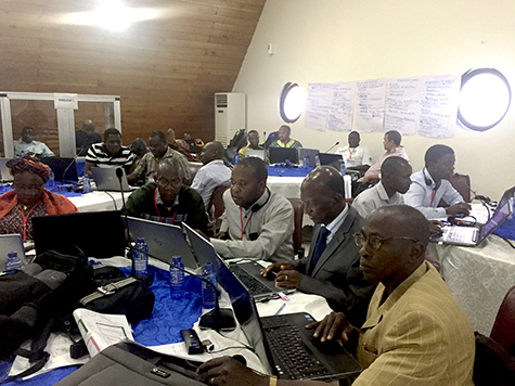
|
| Participants learn how to critically evaluate climate information for adaptation planning in a workshop held May 29‒June 1 in Ada, Ghana organized by CIESIN through the USAID-funded West Africa Biodiversity and Climate Change (WA BiCC) project. |
Representatives from six West African countries―Cote d’Ivoire, Ghana, Guinea, Liberia, Sierra Leone, and Togo―participated in the workshop, “Climate Information for Adaptation Planning,” held May 29‒June 1 in Ada, Ghana. Sylwia Trzaska, CIESIN associate research scientist, and Emilie Schnarr, research associate, facilitated the workshop, which was sponsored by the West Africa Biodiversity and Climate Change (WA BiCC) project of the U.S. Agency for International Development. The purpose of the workshop was to provide participants, some of whom are involved in the National Adaptation Plan (NAP) process of the United Nations Framework Convention on Climate Change (UNFCCC), with information to critically evaluate climate analyses, identify gaps in climate information, develop solutions to address these gaps, and support stakeholder collaboration within and between countries. Participant feedback was positive, especially with respect to learning how to evaluate climate information in the context of planning climate adaptation initiatives. Workshop participants also discussed the need for an online platform for the six countries to exchange ideas and resources, and enhance climate information data sharing, lessons learned, and accomplishments. CIESIN is one of the implementing partners of the WA BiCC project, which is led by Tetra Tech.
|
|
‘Groundswell’: Modeling Climate Change Impacts on Internal Migration
|
|
June 1, 2018
Alex de Sherbinin, CIESIN associate director for Science Applications, and Susana Adamo, research scientist, played key roles in preparing the recent World Bank report, Groundswell: Preparing for Internal Climate Migration. The report assesses the potential future impacts of climate change on migration within countries in Latin America, South Asia, and sub-Saharan Africa. It was developed by the World Bank Climate Change Group in partnership with CIESIN, the City University of New York (CUNY) Institute for Demographic Research, and the Potsdam Institute for Climate Impact Research. The Groundswell report focuses on the influence of medium- to long-term climate change impacts, including changes in crop production and water availability and sea level rise. Internal migration is inferred from projected changes in population distribution. This novel modeling approach identifies potential “hotspots” of climate-induced in- and out-migration in three regions―Mexico and Central America, East Africa, and South Asia—and also provides a basis for estimating the total number of migrants. Main messages from the report are: • In a worst-case scenario, by 2050 there could be as many as 143 million internal climate migrants in the three regions. • Governments should be aware of the potential for climate impacts to affect population distributions within their countries, and proactively plan in ways that facilitate local adaptation, while assisting those who need to move because of worsening conditions. • Migration can be seen as a positive adaptation strategy, if supported by targeted policies and investments that avoid distress migration. • The number of migrants can be reduced by three major actions: cutting greenhouse gases, incorporating climate migration in development planning, and investing in improved understanding of internal climate migration. The report is available for free from the World Bank.
See: Groundswell: Preparing for Internal Climate Migration
|
|
Mapping Green Infrastructure in New York City Focus of Rockefeller Foundation Meetup
|
|
May 31, 2018
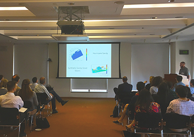
|
| CIESIN GIS programmer Kytt MacManus gives an invited talk on AdaptMap at ‟Mapping Green Infrastructure—Sustainability in the City,” a meetup hosted by Esri and 100 Resilient Cities (100RC) at the Rockefeller Foundation in New York City May 30. |
The first sustainable development “meetup” took place May 30 at the Rockefeller Foundation in New York City, hosted by mapping technology leader Esri and 100 Resilient Cities (100RC). The event, ‟Mapping Green Infrastructure—Sustainability in the City,” drew about 35 professionals in geographic information systems (GIS) and sustainable development. CIESIN GIS programmer Kytt MacManus gave an invited talk on AdaptMap, a mapping tool designed to support decision making regarding flooding, sea level rise, and adaptation strategies for Jamaica Bay, New York. AdaptMap was developed by CIESIN in partnership with the Stevens Institute of Technology and the Wildlife Conservation Society, with funding from the Office of Coastal Management of the National Oceanic and Atmospheric Administration (NOAA). MacManus participated in the meetup under the auspices of the Consortium for Climate Risk in the Urban Northeast (CCRUN), a project of the NOAA Regional Integrated Sciences and Assessments (RISA) program. CIESIN has been part of the CCRUN team since it was launched in 2010.
|
|
NASA Highlights Remote Sensing Data Use by CIESIN Scientist
|
|
May 30, 2018
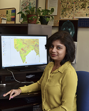
|
| Credit: Chandranath Basak |
CIESIN senior research associate Pinki Mondal has been featured in a NASA Earthdata user profile published online May 24. The user profile is part of a regular series about users of NASA earth science data. Mondal combines remotely-sensed data with census and other data to study the effects of climate change on agricultural systems and communities. Her current research focuses on smallholder farms in tropical countries that can be especially vulnerable to climate variability and to impacts from socioeconomic factors such as urbanization and government policies. She utilizes microwave satellite data, Synthetic Aperture Radar (SAR) data, and high-resolution optical satellite data from a variety of sources to help characterize land use/land cover changes over time in relationship to climate and other factors. For the NASA Socioeconomic Data and Applications Center (SEDAC) operated by CIESIN, Mondal has had lead responsibility for establishing the India Data Collection, which currently consists of the India Village-Level Geospatial Socio-Economic Data Set:1991, 2001 and the India Annual Winter Cropped Area, v1 (2001–2016). She also led development of the Global Summer Land Surface Temperature (LS) Grids, v1, and helped develop the Global Urban Heat Island (UHI) Data Set, v1 (2013), as well as other SEDAC data sets. In August, Mondal will begin a position as assistant professor in the Department of Geography at the University of Delaware in Newark, Delaware.
See: NASA Earthdata User Profile
|
|
Earth Observation Data Providers and Users Share Best Practices in Italy
|
|
May 4, 2018
The Group on Earth Observations (GEO), a voluntary international partnership of more than 100 national governments and 125 participating organizations, brought together both providers and users of Earth observation data at the European Space Agency in Frascati, Italy, May 2–4. The 3rd GEO Data Providers Workshop served as a venue to share knowledge and best practices in data management and use, in support of the ongoing development of the Global Earth Observation System of Systems (GEOSS). The workshop, which drew some 200 participants from more than 130 organizations and 33 countries, included three days of sessions and a two-day “hackathon” connecting data providers and users in the GEOSS Platform community. Alex de Sherbinin, associate director for Science Applications and deputy manager of the NASA Socioeconomic Data and Applications Center (SEDAC) operated by CIESIN, gave a lightning talk on an international initiative to improve the quality and coordination of global-scale georeferenced data on human settlements, infrastructure, and population, known as the POPGRID data collective. He also gave the presentation, “GEOSS Data Management Principles: Importance and Implementation,″ co-authored with Gregory Giuliani of the University of Geneva and Joan Maso of CREAF, a research center in Barcelona, in a plenary session on the first day of the workshop.
See: 3rd GEO Data Providers Workshop
The POPGRID Data Collaborative (13.8MB PDF)
GEOSS Data Management Principles: Importance and Implementation (9.7MB PDF)
|
|
Spatial Dimensions of Population and Vulnerability Addressed in Denver and Cambridge
|
|
May 1, 2018
CIESIN research scientist Susana Adamo and CIESIN director Robert Chen participated in two different scientific conferences, presenting recent work on the geospatial dimensions of population, infrastructure, and social vulnerability. At the annual meeting of the Population Association of America (PAA) April 26–28 in Denver, Colorado, Adamo presented the paper, “Social Vulnerability in Shoreline Counties of Connecticut, New York, and New Jersey, 1990–2010,” co-authored with senior research associate Valentina Mara, senior research staff associates Olena Borkovska and Jane Mills, and CIESIN alumna Erin Doxsey-Whitfield of Fiera Biological Consulting in Canada. This work stemmed from a NASA-supported research project on the Vulnerability of the U.S. Atlantic Coast to Hazards Associated with Extreme Winter Storms (StormEVAAC). Adamo also presented the poster, “Global Spatial Distribution of Age and Sex Structures,” co-authored with geographic information specialist Linda Pistolesi, Geographic Information System (GIS) programmer Kytt MacManus, Mills and Borkovska, information specialist Maria Elisa Lukang, and associate director for Geospatial Applications Greg Yetman. The poster describes efforts to create a new global data set on Basic Demographic Characteristics as part of the Gridded Population of the World version 4.10 data collection, available via the NASA Socioeconomic Data and Applications Center (SEDAC) operated by CIESIN. The PAA is a nonprofit, scientific, professional organization established to better the human condition through research on issues related to human population. The Center for Geographic Analysis (CGA) at Harvard University, together with the Harvard Data Science Initiative and Esri, held its 2018 conference, “Illuminating Space and Time in Data Science,” April 26–27 in Cambridge, MA. Chen participated in a panel on the topic, “Geography, Civic Engagement, and the Future of Data Science,” giving a short presentation, “Why We Need Both Geography & Data Science to Achieve Sustainable Development.” He focused on the need for both geographic information scientists and data scientists to collaborate to address pressing sustainable development challenges, for example, in developing integrated spatio-temporal data and models of human settlements, infrastructure, and population dynamics. The CGA was established in 2005 to support research and teaching in all disciplines across Harvard University with emerging geospatial technologies.
See: Population Association of America Annual Meeting 2018
2018 CGA Conference: Illuminating Space and Time in Data Science
|
|
Massive Open Online Course on Environment and Security Reaches Thousands Worldwide
|
|
April 30, 2018
|
| An eight-week Massive Open Online Course (MOOC) offered by the SDG Academy March 1 to April 26 provided an in-depth introduction to the multiple roles that natural resources and the environment play in the onset, escalation, resolution of, and recovery from violent conflict. CIESIN deputy director Marc Levy was one of the core faculty members for the course, in which nearly 10,000 participants from about 150 countries enrolled. |
Nearly 10,000 participants from about 150 countries enrolled in a free, eight-week Massive Open Online Course (MOOC) that provided an in-depth introduction to the multiple roles that natural resources and the environment play in the onset, escalation, resolution of, and recovery from violent conflict. The course, “Environmental Security and Sustaining Peace,” ran from March 1 to April 26, incorporating diverse technologies in the curriculum such as live webinars and video chats between teacher and student, together with traditional lectures and assigned readings. Students from across the globe needed only an Internet connection to participate. “I've taught classes over Skype from 10,000 miles away, but I've never held office hours from an airplane before,” noted CIESIN deputy director Marc Levy, who was one of the core faculty members for the course. Other faculty included Erika Weinthal of Duke University, Richard Matthew of the Blum Center for Poverty Alleviation and Sustainable Development at the University of California Irvine, David Jensen of the United Nations Environmental Cooperation for Peacebuilding Programme, and Carl Bruch of the Environmental Law Institute. The non-credit-granting course was aimed at peace and security specialists, natural resource experts, sustainable development practitioners, and advanced undergraduates and graduate students. It was offered by the SDG Academy, an educational initiative of the United Nations Sustainable Development Solutions Network. Levy leads the Environment and Security Program at CIESIN, which for more than a decade has organized workshops, academic courses, and training on emerging aspects of environment and security linkages, including executive training in environmental peacebuilding.
See: Massive Open Online Course (MOOC): “Environmental Security and Sustaining Peace”
|
|
Workshop in Rio Highlights Best Practices for Managing Scientific Data
|
|
April 24, 2018
|
At the Latin America and the Caribbean Scientific Data Management Workshop in Rio de Janeiro, Brazil, April 17–18, Alex de Sherbinin, CIESIN associate director for Science Applications, presented a keynote address on trends in scientific data management, co-authored with Wim Hugo, Chief Data and Information Officer with the South African Environmental Observation Network (SAEON). The workshop was convened by the International Council for Science (ICSU) World Data System (WDS) and hosted by the Brazilian Academy of Sciences. It highlighted best practices for scientific data repositories located throughout Latin America and the Caribbean as well as initiatives that are either under way or in the process of being developed, their strengths and limitations, and new opportunities for collaboration. In addition, future trends and perspectives for scientific data systems, as well as criteria and standards for certification of data repositories, were discussed. Some 150 participants from throughout the region attended. Video recordings of the workshop presentations are available online via Facebook (de Sherbinin′s presentation begins at approximately 14:30 in the Day 1 Morning video). Following the workshop, de Sherbinin participated in the WDS Scientific Committee meeting April 19–20.
See: Latin America and the Caribbean Scientific Data Management Workshop
New trends and challenges for scientific data management (2MB PDF)
|
|
CIESIN Staff Engage with Project Partners and Government Stakeholders in Nigeria and Tanzania
|
|
April 23, 2018
CIESIN deputy director Marc Levy and senior research associate Sandra Baptista traveled to Abuja, Nigeria, April 9–13 to meet with project partners in the Geo-referenced Infrastructure and Demographic Data for Development (GRID3) initiative: Tracy Adole and Claire Dooley of World Pop/Flowminder; GRID3 Nigeria National Coordinator Inuwa Yau Barau; Andat Dasogot of the United Nations Population Fund (UNFPA) Nigeria Country Office; and Adam Thompson, Dami Sonoiki, Steve Felix-Uduh, Jerome Oyetoro, and Bethlehem Assena of eHealth Africa. They also met with several government stakeholders, including the Office of the Surveyor General of the Federation, the National Boundary Commission, the National Population Commission, the National Bureau of Statistics, and the National Space Research and Development Agency. While in Nigeria, they participated in a Special Stakeholders Meeting on the GRID3 project, held at the Ministry of Budget and National Planning. Following this visit, Levy and senior research staff assistant Kira Topik continued on to Dar es Salaam and Zanzibar, Tanzania, April 16–20 to meet GRID3 project partners Dooley, Sarchil Qader, and Richard Wood of World Pop/Flowminder; Tapiwa Jhamba and Frederick Okwayo of UNFPA; and several government stakeholders, including representatives from the National Bureau of Statistics, University of Dar es Salaam, Tanzania Data Lab, the Office of the Chief Government Statistician-Zanzibar, and the Ministry of Health-Zanzibar. The GRID3 project is funded by the Bill & Melinda Gates Foundation and the United Kingdom’s Department for International Development. GRID3 aims to build national capacity to collect, analyze, integrate, disseminate, and utilize high-resolution population, infrastructure, and other reference data in support of sustainable development and humanitarian response priorities.
|
|
Lamont Campus Scientists Promote Environmental Awareness at Local Earth Day Fair
|
|
April 18, 2018
As part of festivities worldwide celebrating Earth Day, CIESIN participated in a fair at St. Thomas Aquinas College (STAC) in Sparkill, New York, April 17, co-hosted by STAC and Columbia University′s Lamont-Doherty Earth Observatory. The free event, held for the third year, was attended by both undergraduate and K-12 students and educators, together with members of the general public. Senior research staff assistant Alyssa Fico coordinated CIESIN’s participation in the event, with the assistance of geographic information specialist Linda Pistolesi, staff associate Emilie Schnarr, and CIESIN director Robert Chen. They demonstrated the Hazards Mapper and HazPop mobile app developed by the NASA Socioeconomic Data and Applications Center operated by CIESIN. They also engaged attendees in an interactive data gathering exercise using online geographic information system (GIS) software to locate nearby areas of interest such as eateries, parks, and schools. The fair featured environmental science projects conducted by STAC students as well as a range of hands-on science education activities offered by other scientists from around the Lamont campus.
|
|
Geographers Examine Population and Infrastructure Mapping Approaches
|
|
April 16, 2018
Geographers from across the U.S. and the world met in New Orleans April 10–14 at the annual meeting of the American Association of Geographers (AAG), to present and discuss recent and ongoing research on diverse geographic topics, including hazards, urbanization, public engagement. Several sessions on human settlement and population mapping were organized, including two on high-resolution population modeling and a session on advancements in detecting and projecting population and the footprint of human settlements. CIESIN director Robert Chen gave a presentation at the latter session on the ongoing efforts of the POPGRID Data Collective to advance the use and impact of geospatial settlement, infrastructure, and population data in sustainable development and other applications. Greg Yetman, associate director for Geospatial Applications, discussed mapping green infrastructure and impervious surfaces in New York City, in a session, “Making the City Green.″ His presentation was co-authored with John Squires, senior research staff assistant, and was based on work supported by the U.S. National Science Foundation as part of the project, Developing High Performance Green Infrastructure Systems to Sustain Coastal Cities, led by Patricia Culligan of the Department of Civil Engineering and Engineering Mechanics and the Urban Design Lab. POPGRID activities are supported in part by the Bill & Melinda Gates Foundation and by the NASA Socioeconomic Data and Applications Center (SEDAC) operated by CIESIN.
See: “Mapping Green Infrastructure and Impervious Surfaces in the City of New York”
“The POPGRID Data Collective: Advancing the Use and Impact of Geospatial Population and Infrastructure Data”
|
|
Recent Papers Examine Land Use Trends and Patterns in Asia
|
|
April 13, 2018
Current trends suggest that the already extensive populations of the Asian megadeltas, where more than 174 million people now live less than 7 meters above sea level, will continue to grow. A new study appearing in the journal Global and Planetary Change combines updated gridded population density data with data on “night-time lights″ measured from space and a digital elevation model to assess the spatial evolution of population and development on the nine Asian megadeltas. The invited research article, “Decades of Urban Growth and Development on the Asian Megadeltas,” is authored by Lamont Research Professor Christopher Small, together with Daniel Sousa, a graduate student with the Columbia University Department of Earth and Environmental Sciences; CIESIN associate director Gregory Yetman and GIS programmer Kytt MacManus; and Christopher Elvidge of the National Oceanic and Atmospheric Administration (NOAA). The gridded population data are from the fourth version of the Gridded Population of the World data collection developed by the NASA Socioeconomic and Data Applications center operated by CIESIN. MacManus is also a co-author of “Palm Oil in Myanmar: A Spatiotemporal Analysis of the Effects of Industrial Framing on Biodiversity Loss,” which presents the results of a spatial analysis to determine areas in Myanmar best suited for oil palm tree growth. Findings suggest potential tension in the Tanintharyi region between suitability of oil palm trees and biodiversity protection. Kristopher Nicholas, a recent Columbia College graduate and an advisee of MacManus, was the lead author of the paper, which is published in the open access journal, Global Health: Science and Practice. MacManus serves as a lecturer at Columbia College and the School of International and Public Affairs.
See: “Decades of Urban Growth and Development on the Asian Megadeltas”
“Palm Oil in Myanmar: A Spatiotemporal Analysis of the Effects of Industrial Framing on Biodiversity Loss” (3.33MB PDF)
|
|
Global Compact for Migration Negotiations Continue in New York
|
|
April 6, 2018
The third round of intergovernmental negotiations on the Global Compact for Migration was held at United Nations headquarters in New York City April 3–6. In conjunction with the negotiations, the Platform on Disaster Displacement (PDD) organized a briefing April 4 at the Permanent Mission of the People’s Republic of Bangladesh to discuss migration in the context of disasters and climate change. Susana Adamo, CIESIN research scientist, and Alex de Sherbinin, associate director for Science Applications, spoke on data and knowledge gaps at the briefing. Other event speakers included Professor Walter Kaelin, Envoy of the Chair of the PDD, and representatives of Refugees International, the United Nations High Commissioner for Refugees, and the International Organization for Migration. The PDD, which is currently chaired by Bangladesh, is following up on work begun by the Nansen Initiative to implement the Nansen Initiative Protection Agenda, endorsed by 109 governmental delegations during a Global Consultation in October 2015. The Global Compact for Migration will be the first intergovernmental negotiated agreement prepared under the auspices of the United Nations to cover all dimensions of international migration in a holistic and comprehensive manner.
See: “Addressing the Needs of Persons Moving in the Context of Disasters and Climate Change in the Global Compact for Migration,” (Briefing, April 4, 2018)
Intergovernmental Negotiations—Third Round
|
|
Visitors from Japan and France to Focus on Remote Sensing and Geospatial Applications
|
|
April 4, 2018
CIESIN welcomes two new visitors, Koji Osumi and Rebeca de Bakker Doctors, this spring. Osumi, who is section chief in the Geographic Department, Geoinformation Processing Division at the Geospatial Information Authority of Japan, is being hosted by the Geospatial Applications Division for one year. He will be collaborating with the associate director of the division, Greg Yetman, and with associate director of Science Applications, Alex de Sherbinin, on studies of spectral mixing analysis from satellite imagery and modeling of temporal change using vegetation indexes. Osumi has a BS and MA in earth science from Hokkaido University and has worked at both the Geospatial Information Authority and the Ministry of the Environment in Japan. An Alliance Program intern from École Polytechnique, de Bakker Doctors is conducting research on the use of geospatial data for decision making in complex settings, supervised by deputy director Marc Levy. She will work with senior research associate Sandra Baptista and team members on the new Geo-referenced Infrastructure and Demographic Data for Development (GRID3) initiative. She is studying for an MS in the Challenges for Environmental Sciences program at École Polytechnique, and has a BSc in economics from the Pontifical Catholic University of Rio de Janeiro.
|
|
Displacement from Sea Level Rise Addressed at Annapolis Workshop
|
|
April 3, 2018
Alex de Sherbinin, CIESIN associate director for Science Applications, participated in a National Socio-Environmental Synthesis Center (SESYNC) Pursuit event March 28–29 that focused on populations displaced by sea level rise and coastal extremes. The workshop was hosted by the University of Maryland in Annapolis and led by David Wrathall of Oregon State University and Valerie Mueller of Arizona State University. Twenty researchers from a variety of academic and government institutions in the United States and abroad were invited to participate. Funded by a grant from the U.S. National Science Foundation, SESYNC facilitates interdisciplinary collaborations to develop data-driven solutions to socio-environmental issues.
See: SESYNC Project Description: "A forecast of the timing, locations, sequence and likeliest destinations of populations displaced by sea level rise and coastal extremes"
|
|
Socioeconomic Data for India and New Global Air Pollution Grids Released
|
|
April 3, 2018
Two new data sets have been released by the NASA Socioeconomic Data and Applications Center (SEDAC) operated by CIESIN. The India Village-Level Geospatial Socio-Economic Data Set: 1991, 2001, provides detailed administrative boundary data for India (village/town-level) together with more than 200 socioeconomic variables from the 1991 and 2001 censuses. The data are available for the 28 states and combined Union Territories in existence in 1991 and 2001. The data set was developed as part of a research project on the dynamics and determinants of land change in India by Prasanth Meiyappan of the University of Illinois and colleagues from India and from Columbia University. This is the second data set in the India Data Collection, which also includes the data set, India Annual Winter Cropped Area, v1 (2001–2016). SEDAC has also released a new data set on global patterns of fine particulate matter (PM2.5) over nearly two decades: the Global PM2.5 Grids from MODIS, MISR and SeaWiFS Aerosol Optical Depth (AOD) with Geographically Weighted Regression (GWR), 1998–2016. The data set consists of estimated annual concentrations (micrograms per cubic meter) of PM2.5, with dust and sea salt removed, on a grid of 0.01 degree resolution, or about 1 km at the equator. This version supersedes a previous data set with coarser resolution (0.1 degree, or about 10 km) and data only through 2012. The new data set combines AOD measurements from the NASA Moderate Resolution Imaging Spectroradiometer (MODIS), Multi-angle Imaging SpectroRadiometer (MISR), and the Sea-Viewing Wide Field-of-View Sensor (SeaWiFS) with a chemical transport model. GWR is used to adjust estimates drawing on available ground-based measurements. The data set was developed by a team led by Aaron van Donkelaar at Dalhousie University in Canada.
See: The India Village-Level Geospatial Socio-Economic Data Set: 1991, 2001
Global Annual PM2.5 Grids from MODIS, MISR and SeaWiFS Aerosol Optical Depth (AOD) with GWR, v1 (1998 – 2016)
|
|
Review Paper Recognized by Environmental Research Letters
|
|
April 2, 2018
The paper, “Is Voluntary Certification of Tropical Agricultural Commodities Achieving Sustainability Goals for Small-Scale Producers?: A Review of the Evidence,” has been selected by the editors of the journal Environmental Research Letters for inclusion in its exclusive ‟Highlights of 2017” collection. University Professor Ruth DeFries of the Columbia University Department of Ecology, Evolution and Environmental Biology (E3B) authored the paper together with CIESIN research associate Pinki Mondal and colleagues from Johns Hopkins University, Yale University, and Biodiversity International. Papers were selected on the basis of referee endorsement, originality, scientific impact, and breadth of appeal. The paper evaluates whether voluntary certification (for example, Fair Trade International, Organic, Utz) of bananas, cocoa, coffee, oil palm, and tea has achieved environmental benefits and improved economic and social outcomes for small-scale farmers. The authors conclude that while not a panacea, such certification programs can sometimes play a role in meeting sustainable development goals. Environmental Research Letters is a high-impact, open-access journal covering all environmental science published by IOPscience (impact factor of 4.404 in 2016).
See: Environmental Research Letters Highlights of 2017
|
|
Diverse Data Experts Convene in California, England, and Germany
|
|
March 28, 2018
|
| Attendees at the workshop, “Linkages between Earth Observations and Ecosystem Services,” March 21‒22 in Palo Alto, California. CIESIN research scientist Susana Adamo is third from left in the first standing row. |
Potsdam and Berlin in Germany, Palo Alto in California, and Bristol in the United Kingdom were the venues for meetings of three different communities concerned with digital data for different applications. Robert Downs, CIESIN senior digital archivist, traveled to Potsdam March 18 for the FAIR Data Workshop organized by the American Geophysical Union and then to Berlin March 20 for a meeting of the Research Data Alliance (RDA) Technical Advisory Board and Chairs. He then participated in the 11th RDA Plenary March 21–23, where he gave presentations about the World Data System of the International Council for Science (ICSU-WDS), principles and practices for enabling open data use, and characterizing data quality. He also co-convened a session of the RDA interest group on Repository Platforms for Research Data, which he co-chairs. CIESIN research scientist Susana Adamo joined researchers from academia, government, non-governmental organizations, and the private sector for a March 21–22 workshop in Palo Alto, “Linkages between Earth Observations and Ecosystem Services,” as part of the Natural Capital Symposium. This was the second workshop in a series of three exploring the use of Earth observations in ecosystem services research and applications, organized by the Institute on the Environment-University of Minnesota, Stanford Woods Institute-Stanford University, and the Gund Institute for Environment-The University of Vermont, and funded by NASA. The emerging community of organizations and individuals involved in data for international development gathered in Bristol March 21–23 for the first Data for Development Festival organized by the Global Partnership for Sustainable Development Data (GPSDD). CIESIN director Robert Chen and deputy director Marc Levy both attended, giving presentations on two initiatives addressing foundational geospatial data needs for sustainable development. Chen described efforts to coordinate global-scale data on human settlements, infrastructure, and population through POPGRID, a project supported by the Bill & Melinda Gates Foundation (BMGF). Levy participated in a special session on the new Geo-referenced Infrastructure and Demographic Data for Development (GRID3) initiative, supported by BMGF and the UK Department for International Development (DFID). GRID3 aims to build national capacity to collect, analyze, integrate, disseminate, and utilize high-resolution population, infrastructure, and other reference data in support of national sectoral development priorities, humanitarian efforts, public health, and sustainable development goals (SDGs). Chen remained in Bristol March 24–25 to co-chair a meeting of the Thematic Research Network on Data and Statistics (TReNDS) of the United Nations Sustainable Development Solutions Network. CIESIN is an anchor partner of the GPSDD and coordinating partner of GRID3.
|
|
CIESIN Staff Contribute to Key Research Publications
|
|
March 23, 2018
Several CIESIN staff members have contributed to a range of publications in prominent journals and books and to a major new World Bank report. Alex de Sherbinin, associate director for Science Applications, is lead author of the chapter, “Geospatial Modeling and Mapping,” in the Routledge Handbook of Environmental Displacement and Migration. Edited by Robert McLeman of Wilfrid Laurier University and François Gemenne of the Hugo Observatory at the University of Liège, Belgium, the Handbook constitutes a major review of research on how environmental variability and change influence current and future global migration patterns and may trigger large-scale population movement. The chapter′s co-author is Ling Bai, a doctoral student in the Department of Sociology at the University of Southern California. The World Bank report, Groundswell: Preparing for Internal Climate Migration, was released March 19 through the Bank's Open Knowledge Repository. Alex de Sherbinin and research scientist Susana Adamo are among the co-authors of the report, which examines the potential impacts of climate change on population movement within countries in Latin America, South Asia, and sub-Saharan Africa in future decades. CIESIN coordinated the study with the Institute for Demographic Research at the City University of New York and the Potsdam Institute for Climate Impact Research. Kytt MacManus, CIESIN GIS programmer, is a co-author of the paper, “Flood Hazard Assessment from Storm Tides, Rain and Sea Level Rise for a Tidal River Estuary,” appearing in the journal, Natural Hazards. The research team led by Philip Orton of Stevens Institute of Technology found that areas along the Hudson River south of Poughkeepsie are dominated by storm surge-induced flooding, whereas areas north of Poughkeepsie to Albany are impacted more by precipitation-based flooding. The research included further development of the Hudson River Flood Impact Decision Support System, and was supported by the New York State Energy Research and Development Authority (NYSERDA). MacManus also contributed to a second paper, “NASA’s Black Marble Nighttime Lights Product Suite,” published in the journal, Remote Sensing of Environment. A companion to the well-known “Blue Marble” image of the Earth, the Black Marble provides insight into distributions and changes in visible lights at night. The lead author of the paper, Miguel Román of the NASA Goddard Space Flight Center, is collaborating with CIESIN on two new projects funded by NASA in support of the Human Planet initiative of the Group on Earth Observations (GEO).
See: “Flood Hazard Assessment from Storm Tides, Rain and Sea Level Rise for a Tidal River Estuary”
“NASA’s Black Marble Nighttime Lights Product Suite”
"Geospatial modeling and mapping” book chapter
|
|
Seminar Showcases New World Bank Report on Climate Change and Migration
|
|
March 22, 2018
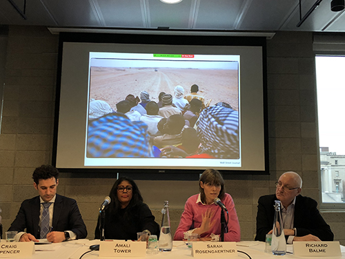
|
| Members of a panel on climate change and migration at a March 20 seminar at Columbia University as part of launch activities for the World Bank report, Groundswell: Preparing for Internal Migration. Left to right: Craig Spencer, Amali Tower, Sarah Rosengaertner, and Richard Balme. The panel also included Alex de Sherbinin, CIESIN associate director for Science Applications, and Richard Seager of the Lamont-Doherty Earth Observatory and was moderated by CIESIN deputy director Marc Levy (not shown). |
The World Bank recently published a new report, Groundswell: Preparing for Internal Climate Migration, which was co-authored by scientists from CIESIN, the City University of New York Institute for Demographic Research (CIDR), and the Potsdam Institute for Climate Impact Research. The report projects that, without concrete climate and development action, more than 143 million people—or around 2.8 percent of the population of sub-Saharan Africa, South Asia, and Latin America—could be forced to move within their own countries by 2050 to escape the slow-onset impacts of climate change. In conjunction with the report launch, Alex de Sherbinin, associate director for Science Applications and one of the report′s main authors, organized a seminar at Columbia University March 20. The seminar featured preliminary remarks by Stephen Hammer, head of climate policy for the World Bank, followed by a presentation on modeling methods and results, and an expert panel moderated by CIESIN deputy director Marc Levy. The panel featured faculty and other experts from across Columbia, including Richard Seager from the Lamont-Doherty Earth Observatory, Craig Spencer from the Mailman School of Public Health, and Sarah Rosengaertner from Columbia's Global Policy Initiative. Amali Tower, executive director of Climate Refugees, and Richard Balme, a visiting scholar from SciencesPo in France, also participated. The seminar was the second in a new seminar series on population dynamics and environmental change, organized by CIESIN, the Population Council, CIDR, and the UN Population Division. More than 60 researchers and interested individuals from the region attended.
See: Groundswell: Preparing for Internal Climate Migration (Report)
Seminar on Climate Change and Migration (video)
|
|
Available for the First Time: Global Gridded Data Set on Population Distribution by Age and Sex
|
|
March 14, 2018
The most recent update to the fourth version of the Gridded Population of the World data collection, GPW version 4.10, contains the first global data set on the spatial distribution of population broken down into different age groups by sex (male and female). The data were developed by the NASA Socioeconomic Data and Applications Center (SEDAC) operated by CIESIN. Prior versions of GPW provided estimates of the total population in each latitude-longitude grid cell. Now with the inclusion of age and sex information drawn from the 2010 round of national population censuses, it is possible to map specific demographic subgroups such as elderly populations, school-aged children, young adults, and women of childbearing age. This enables users to better understand spatial variations in age structure and sex ratios within countries for specific regions of interest. The age and sex data expand GPW’s usefulness in many research and application areas, including vulnerability and risk mapping, urbanization and migration studies, and emergency response and public health applications. In addition, gridded age and sex data can help in monitoring and achieving the Sustainable Development Goals (SDGs), especially with respect to efforts to disaggregate data to support the objective to “leave no one behind,” e.g., the elderly, the young, and other subgroups who may be geographically isolated. The new downloadable data consist of population counts and density rasters for 5-year age groups and for selected age categories (0–14, 15–64, 65 and older), as totals and by sex. A raster data set of women of childbearing age (15–49) is also available. All of the GPWv4.10 raster data sets are now available in ASCII and netCDF formats as well as GeoTiff. Files with coarser resolution (2.5, 15, 30, and 60 arc minutes) may be selected to enable faster raster processing and compatibility with data sets from other scientific domains. A vector data set, “Administrative Unit Center Points,” has been updated to include age and sex attributes. First developed in 1994, GPW provides population estimates on a latitude-longitude grid for all land on the planet except Antarctica, created through analysis of census and administrative boundary data from every country in the world. The gridded format permits easy integration with a wide range of data, supporting research, planning, and applications in energy and water management, disaster and humanitarian response, agriculture and food security planning, public health interventions, transportation and communications development, urban and coastal zone planning, and many other aspects of sustainable development. The free, downloadable data and descriptions, including documentation and maps, are available at http://sedac.ciesin.columbia.edu/data/collection/gpw-v4/whatsnewrev10. The data are disseminated using the Creative Commons Attribution 4.0 International (CC-BY-4.0) license, which permits free sharing, adaptation, and use of the data for both commercial and noncommercial purposes, so long as appropriate credit is given.
|
|
New Project Supports Developing Countries in Using Geo-referenced Data to Advance Development Goals
|
|
March 12, 2018
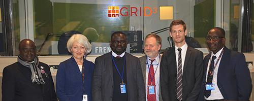
|
| Participants in the launch of a new project, “Geo-referenced Infrastructure and Demographic Data for Development (GRID3),″ at at a side event of the 49th session of the United Nations Statistical Commission held March 7 in New York City. Left to right: Roger Shulungu Runika, director general, Ministry of Planning, National Statistics Institute, Democratic Republic of the Congo; Rachel Snow, chief, UNFPA; Homere Ngoma Ngoma, census coordinator at the Central Bureau of the Census, National Statistics Institute, Democratic Republic of the Congo; Marc Levy, deputy director, CIESIN; Linus Bengtsson, executive director and co-founder, Flowminder; and Tapiwa Jhamba, technical advisor, UNFPA. |
A new project, “Geo-referenced Infrastructure and Demographic Data for Development (GRID3),” was launched at a side event of the 49th session of the United Nations Statistical Commission held March 7 in New York City. The side event featured a panel presentation on project objectives and applications by representatives of core GRID3 partners, including Marc Levy, CIESIN deputy director; Linus Bengtsson, executive director and co-founder of Flowminder; Rachel Snow, chief, Population and Development Branch, United Nations Population Fund (UNFPA); and Tapiwa Jhamba, technical advisor, also of UNFPA. Joining the core partners as a panelist was Homere Ngoma Ngoma, census coordinator at the Central Bureau of the Census, National Statistics Institute, Democratic Republic of the Congo (DRC), who made a presentation on the 2019 DRC census and the potential impact of GRID3 involvement. Also attending were CIESIN senior research staff assistants Olena Borkovska and Kira Topik, and project coordinator Kevin Tschirhart. A lively question-and- answer session followed the presentations. GRID3 is facilitating the collection, analysis, integration, dissemination, and utilization of high-resolution population, infrastructure, and other reference data in support of national sectoral development priorities, humanitarian efforts, health, and sustainable development goals (SDGs). The project aims to increase developing countries’ capabilities for mapping population distribution as a way of ensuring that everyone, especially the most vulnerable, is counted, refining development priorities and extending and improving the scope and efficacy of countries’ development efforts. The project is funded by the Bill & Melinda Gates Foundation and the United Kingdom′s Department for International Development (DFID). Sandra Baptista, senior research associate, is a co-project investigator, with Marc Levy.
|
|
Mapping of Afghanistan's Population Described at March 8 Seminar
|
|
March 9, 2018
Heather Chamberlain of WorldPop and Flowminder visited CIESIN March 8 in Palisades, New York to give an informal talk on high-resolution population mapping in Afghanistan. Chamberlin is a geographer based at Southampton University in the UK working on humanitarian applications of Geographic Information Systems (GIS) and remote sensing. She discussed methods used to create population estimates for Afghanistan using statistical models, geographic correlates, and survey data. CIESIN is a partner with WorldPop and the University of Louisville on the project, “Global High Resolution Population Denominators,″ supported by the Bill & Melinda Gates Foundation. WorldPop is also participating in the POPGRID initiative, which seeks to expand and coordinate the international community of data providers, users, and sponsors of georeferenced data on population, human settlements, and infrastructure.
|
|
Online Presentations Demonstrate Hazard and Health Applications
|
|
March 8, 2018
A talk given by CIESIN director Robert Chen, “Who’s at Risk? Rapid Mapping of Potential Hazard Exposure,” has been released online by the Federal Emergency Management Agency (FEMA) as part of its inaugural PrepTalks series. PrepTalks seek to promote conversation and innovation on issues facing emergency managers through a video presentation, discussion guide, and other information resources. Chen’s presentation features a range of hazard mapping tools and data developed by the NASA Socioeconomic Data and Applications Center (SEDAC) and other groups useful for assessing exposure and vulnerability to a variety of natural hazards. Eight PrepTalks were recorded at George Washington University in Washington DC in January 2018, including presentations by Dennis Mileti of the University of Colorado, Francis Ghesquiere of the Global Facility for Disaster Reduction and Recovery, and Amanda Ripley of the Emerson Collective. Chen also presented “Mapping the Human Planet: Integrating Settlement, Infrastructure and Population Data to Leave No One Behind” in a panel on geospatial information for addressing inequalities and safeguarding public health, organized by the World Health Organization (WHO). The panel was part of the Statistical-Geospatial Integration Forum side event held March 5 in conjunction with the 49th session of the United Nations Statistical Commission at United Nations headquarters in New York City. Marie Haldorson of Statistics Sweden, who co-chairs the Working Group on Geospatial Information of the Inter-agency and Expert Group on SDG Indicators (IAEG-SDGs), moderated the panel, which also included Lisa Bersales of the Philippines Statistical Agency, Rifat Hossain of WHO, and Lawrence Friedl of NASA. The Forum was broadcast live on UN WebTV and is available on demand.
See: FEMA PrepTalk: “Who’s at Risk? Rapid Mapping of Potential Hazard Exposure”
UN Web TV video (Chen presentation starting at about 54:30)
|
|
Population and Settlement Data and Tools Examined at Second POPGRID Meeting
|
|
March 5, 2018
More than 40 experts on mapping of human settlements, infrastructure, and population from a range of organizations participated in the second “POPGRID″ working meeting, held at the Lamont campus February 28–March 1 and at the Population Council in New York City March 2. Organized by CIESIN with support from the Bill & Melinda Gates Foundation (BMGF) and the Earth Institute, the meeting focused on the rapidly growing number and variety of georeferenced data products aimed at improving understanding of human settlement patterns, population distribution, and associated built infrastructure. New mapping approaches are being developed that take advantage of new sources of data such as radar, night-time lights, and high-resolution remote sensing. More information about these data and how they compare is needed to support not only scientific research, but also a variety of critical applications in sustainable development, disaster risk management and response, public health planning, and resource management. Participants in the meeting came from organizations in both the United States and Europe, including the European Commission′s Joint Research Centre, the German Aerospace Center, the Group on Earth Observations, the Oak Ridge National Laboratory of the U.S. Department of Energy, and the U.S. Bureau of the Census. Private companies such as Esri, Facebook, and Google were also represented. Increased collaboration among these groups, and between both producers and users of these data, will improve data quality and usability, reduce duplication, facilitate data access and sharing of resources, and improve the impact and effectiveness of the data for both research and applications. A new POPGRID web site has been released that brings together information about the different data products currently available and that will serve as an access point for the growing number of tools that provide visualization and analysis tools for the different data sets. Three POPGRID scientific sessions were held at the fall American Geophysical Union meeting in New Orleans in December 2017, and several additional sessions are scheduled April 14 at the annual meeting of the American Association of Geographers, also in New Orleans.
See: POPGRID Web site
|
|
New Projects Seek to Improve Population and Environmental Mapping
|
|
March 1, 2018
CIESIN is leading or participating in several new projects aimed at improving integration of human settlement, population, and environmental data in sustainable development efforts. CIESIN director Robert Chen is the principal investigator for the three-year project, “Population and Infrastructure on Our Human Planet: Supporting Sustainable Development through Improved Spatial Data and Models for Human Settlements, Infrastructure and Population Distribution Based on Earth Observations.” The project team will work with national statistical offices and other agencies in several developing countries to better utilize population and related data in sustainable development monitoring and decision making. Partners include experts from the University of Louisville, ImageCat, Inc., NASA’s Goddard Space Flight Center (GSFC), Baruch College, and Yale University. Funding is being provided by the NASA Applied Sciences program, as part of its support of the Human Planet Initiative of the Group on Earth Observations (GEO). Senior research associate Xue Liu has also received NASA funding as part of a three-year effort to estimate total carbon in coastal and freshwater peatland forests. The project is led by Lola Fatoyinbo, research scientist with the Biospheric Sciences Laboratory at GSFC, and includes collaborators from the NASA Jet Propulsion Laboratory, the University of Maryland, and the U.S. Forest Service. Kytt MacManus, GIS programmer, is co-investigator of a third project, led by Miguel Román of GSFC, which is focusing on validation of global night-time environmental products, commonly known as night-time lights data. MacManus is leading the evaluation of daily night-time light data for developing near real-time population estimates as well as for improving existing population data products. The project will carry out validation activities in areas such as Puerto Rico, South Dakota, and Bangladesh. NASA has also funded the project, “Mapping the Missing Millions,” led by Jamon Van Den Hoek of Oregon State University. Alex de Sherbinin, associate director for Science Applications, is a collaborator on the project, together with experts from DevSeed and the Humanitarian OpenStreetMap Team. The project aims to improve mapping of approximately 250 million refugees, displaced persons, and other people living in informal settlements, using crowdsourced data, machine learning, and multi-sensor satellite imagery.
|
|
Creator of First Global Gridded Population Data Set Passes Away
|
|
February 28, 2018
Waldo Tobler, world-renowned geographer and cartographer and Professor Emeritus at the University of California, Santa Barbara, passed away February 20 at the age of eighty-eight. Among his many accomplishments, Tobler created the first global gridded population data set, working with colleagues, Uwe Deichmann, Jan Gottsegen, and Kelley Maloy. Tobler also formulated the so-called first law of geography: “Everything is related to everything else, but near things are more related than distant things.” He was an early pioneer in applying digital technologies and mathematical methods to geographic research and visualization, inventing new map projections, reallocation methods, and spatial analysis techniques. In 1994, Tobler was a key participant in the Global Demography workshop held in Saginaw, Michigan, organized by the Science division of what was then the Consortium for International Earth Science Information Network. CIESIN supported Tobler′s development of the initial version of the Gridded Population of the World (GPW) data set, which was based on population and administrative boundary data for about 19,000 administrative units. CIESIN has continued to refine and improve GPW for more than two decades, recently releasing version 4.10 through the NASA Socioeconomic Data and Applications Center (SEDAC). Tobler was a member of the U.S. National Academy of Sciences, recipient of the O.M. Miller Cartographic Medal of the American Geographical Society (AGS), and winner of Esri's Lifetime Achievement in GIS Award, among other honors. For more information about Tobler's work and the planned memorial service, see his department′s Web site.
See: “World Population in a Grid of Spherical Quadrilaterals" by Tobler et al. (1997)
|
|
Seminar Series on Population Dynamics and Environmental Change Launched in New York
|
|
February 28, 2018
The first in a series of monthly seminars on population dynamics and environmental change took place at the Population Council in New York City February 23, organized by CIESIN, the Population Council, the Institute for Demographic Research of the City University of New York (CUNY), and the UN Population Division. The inaugural seminar featured a presentation by Mark Montgomery and Samir Souidi, ‟Lessons from DesInventar: A Critical Look at the Performance of Disaster Databases.” Montgomery, a senior associate with the Population Council and professor in the Economics Department at Stony Brook University, examined the performance of the DesInventar databases for selected countries and hazard types: floods, landslides, drought, and earthquakes. CIESIN associate director for Science Applications, Alex de Sherbinin, is organizing the second seminar in the series, “Modeling the Potential Impacts of Climate Change on Population Distribution and Migration,” to be held March 20, 3‒5 pm, at the Satow Room in Lerner Hall, Columbia University. Advance registration is required. Additional seminars are planned for spring and fall 2018, featuring experts in demography, climate, environmental risk, and public health. The seminars aim to promote exchange and dialogue among those in the New York metropolitan region interested in interdisciplinary research on key issues surrounding population dynamics on a rapidly changing planet.
|
|
Project on Mapping Populations in Remote Areas is Selected
|
|
February 27, 2018
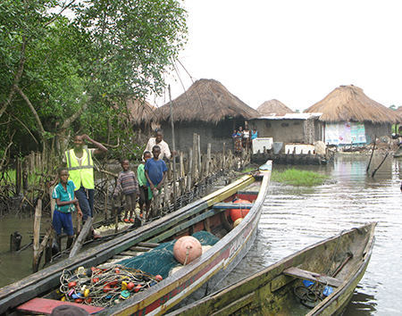
|
| Fishing village in the Sherbro region of Sierra Leone, June 2016. For an award from the World Bank and the Global Partnership for Sustainable Development Data, CIESIN will lead development of an online interface to crowd-source and display basic information on remote villages like this one in Sierra Leone, Liberia, and other mangrove areas in West Africa. |
The World Bank and the Global Partnership for Sustainable Development Data have recently announced twelve new Development Data Innovation Projects, part of a $2.5 million investment in collaborative data innovations for sustainable development. One of the projects, “Estimating and Mapping Populations in Off-Grid and Hard-to-Reach Places,” is led by CIESIN in partnership with the Connectivity Lab at Facebook and Wetlands International Africa. Associate research scientist Sylwia Trzaska is the principal investigator of the project, which seeks to increase the visibility of off-grid, hard-to-reach populations by providing information about the location and size of small settlements/villages through an online interface. The project will leverage high-resolution satellite imagery, volunteered geographic information (VGI), and modeling, with a focus on small settlements within mangrove areas of six data-poor countries in West Africa. These areas share similar landscape and livelihood characteristics and an urgent need for locating and estimating coastal population in areas prone to sea-level rise. The twelve new projects are supported by the World Bank’s Trust Fund for Statistical Capacity Building with financing from the United Kingdom’s Department for International Development (DFID), the Government of Korea, and the Department of Foreign Affairs and Trade of Ireland.″
See: Announcing Funding for 12 Development Data Innovation Projects
|
|
Publications by CIESIN Staff and Visitors Released
|
|
February 24, 2018
Several new publications have recently been released by CIESIN staff members and by former and current visitors. The report, ”Climate Change Vulnerability Assessment in Mangrove Regions of Sierra Leone,” addresses the social and ecosystem vulnerability of the coastal (mangrove) communities of Sierra Leone. This full-length version is an output of activities under a five-year project led by Tetra Tech and funded by the US Agency for International Development (USAID). An abridged version was released in May 2017. The report′s authors include the lead field researcher, Sylwia Trzaska, associate research scientist; Alex de Sherbinin, associate director for Science Applications; Paola Kim-Blanco, senior research associate; Valentina Mara, senior research associate; Emilie Schnarr, staff associate; Malanding Jaiteh, retired geospatial applications specialist; and Pinki Mondal, senior research associate. Dongyong Zhang, who visited CIESIN in 2014, is first author of the book, Sustainable Development and Corporate Social Responsibility, published by Routledge. Zhang is a researcher and associate professor with the School of Management Science at Henan Agriculture University in China, where she focuses on quantitative and qualitative social research and econometrics. Her co-authors are Stephen Morse of the University of Surrey and Uma Kambhampati of the University of Reading in the UK. JiaoJiao Luo, a graduate student with the Department of Land Management at Zhejiang University's School of Public Affairs, is lead author of a paper on urban land expansion and the floating population in China, in press in the journal Cities. CIESIN information scientist Xiaoshi Xing is a co-author of the paper. Luo arrived at CIESIN in November 2017 for a one-year stay to conduct research on urbanization and sustainable development.
See: Report: Climate Change Vulnerability Assessment in Mangrove Regions of Sierra Leone/West Africa Biodiversity and Climate Change (WA BiCC) Project Page
Book: Sustainable Development and Corporate Social Responsibility
Paper: Urban Land Expansion and the Floating Population in China: For Production or for Living?
|
|
Recent Transitions at CIESIN
|
|
February 23, 2018
CIESIN is pleased to welcome Kira Topik as a senior research staff assistant in the Science Applications division, where she is helping manage a new initiative on geospatial data infrastructure in Africa. Topik worked as a casual employee at CIESIN the previous fall and summer, assisting with a major World Bank report and with mapping activities for a project with the New York State Energy Research and Development Authority (NYSERDA). She has an MA in climate and society from Columbia University and a BA in international and intercultural studies, and Spanish, from Pitzer College. Zhen Wu, a graduate student with the School of Geographic Sciences at East China Normal University (ECNU) in Shanghai, has begun a six-month visit focused on geospatial analysis and methods related to coastal environmental change. Wu has a master’s degree in physical geography from ECNU, and a BS in geography science from Hunan University of Science and Technology in Xiangtan, China. Alex de Sherbinin, associate director for Science Applications, and Xiaoshi Xing, information scientist, are serving as Wu′s hosts during her visit. CIESIN bid farewell to Haibin Xia in late December after his one-year research visit. An engineer with the ECNU School of Geographic Sciences, Xia conducted research on the biophysical and climatic correlates of population distribution in China and worked with Alex de Sherbinin on climate change migration modeling. Xia received his PhD, master′s, and bachelor′s degrees from the ECNU College of Resources and Environment Science.
|
|
Population Data, Hazard Exposure, and Sustainable Repositories Addressed in Three DC Area Talks
|
|
January 30, 2018
Greg Yetman, CIESIN associate director for Geospatial Applications, and Robert Chen, CIESIN director, gave three talks in the Washington DC area January 25–29 as part of events organized for three different U.S. government agencies. On January 25, Yetman gave an invited presentation at the MapTech GEO seminar at the U.S. Bureau of the Census in Suitland, Maryland. His presentation, “Integration and Transformation of Census Data: Modeling Population on Raster Surfaces,″ described a range of approaches to modeling population distribution utilized in different data products, including CIESIN's new Gridded Population of the World version 4.10 (GPWv4.10) data set, the High Resolution Settlement Layer (HRSL) data developed in collaboration with Facebook, and other datasets produced through collaborations with the WorldPop project and the European Commission's Joint Research Center (JRC). On January 25-26, Chen attended a two-day workshop, “Creating and Implementing Sustainability Plans for Data Repositories,” organized by the Ecological Society of America on behalf of the U.S. National Science Foundation (NSF). The workshop, held in Alexandria, Virginia, near NSF′s new headquarters, brought together more than 30 managers of digital data repositories, data science experts, and NSF staff members to explore challenges and opportunities in increasing the long-term sustainability of valuable scientific data archives and services given changing technology, user needs, funding environments, and business models. Chen gave a plenary talk about the NASA Socioeconomic Data and Applications Center (SEDAC), which he has managed for more than two decades. The chair of the SEDAC User Working Group, Myron Gutmann of the University of Colorado, was a member of the workshop's organizing committee. Chen returned to the Washington DC area January 29 to give a presentation as part of the PrepTalks Symposium organized by the Federal Emergency Management Agency (FEMA). The Symposium, held at George Washington University, featured eight speakers showcasing cutting-edge research and relevant experience of value to emergency managers. Chen gave the presentation, “Who's at Risk: Rapid Mapping of Potential Hazard Exposure,″ featuring a range of data and tools from SEDAC and other NASA data sources useful in emergency planning and response. The PrepTalks are recorded on video and subsequently posted to YouTube as an online resource for the emergency management community.
|
|
New Report Ranks Nations’ Environmental Performance, Reveals Trends
|
|
January 23, 2018
Air quality is the leading environmental threat to public health, according to the 2018 Environmental Performance Index (EPI) released January 23 at the annual meeting of the World Economic Forum in Davos, Switzerland. The biennial report, which ranks 180 countries on 24 performance indicators across 10 issue categories covering environmental health and ecosystem vitality, was produced by the Yale Center for Environmental Law & Policy (YCELP) and CIESIN. Switzerland is ranked first in environmental performance, followed by France, Denmark, Malta, and Sweden. In 2016, France and Sweden also made the top five. In spite of strong scores on sanitation and air quality, the United States places only 27th in the 2018 EPI, thanks to weak performance on deforestation and greenhouse gas emissions, among other issues. This puts the United States near the back of the industrialized nations, behind France (2nd), the United Kingdom (6th), Germany (13th), Japan (20th), and Canada (25th). Of the large emerging economies, China and India rank 120th and 177th respectively, due to pressures on the environment from high population densities and rapid economic expansion. “The strain on resources from past and current population growth, and the challenges of raising two billion people out of poverty, has meant that these countries face particular challenges,” according to co-author Alex de Sherbinin, associate director for science applications at CIESIN. “From nitrogen pollution, inadequate waste water treatment, air pollutant emissions and concentrations, China and India face severe environmental challenges.” In addition to rankings, the EPI identifies important environmental trends. For example, the report finds that fisheries continue to deteriorate in most countries, and air pollution—a problem largely “solved” in advanced developed countries—is still a critical problem in many developing countries, especially in India, China, and Pakistan. And some countries are failing to address critical problems. Deforestation, for example, has been a significant issue for Indonesia, Malaysia, and Cambodia for the past five years, reflecting broad policy failures, according to the report.
See: 2018 Environmental Performance Index
State of the Planet blog: “Global Environment Report Card Sees Dirty Air, Failing Fisheries”
|
|
CIESIN Staff Honored for Ten Years of Service
|
|
January 19, 2018
Five staff members who joined CIESIN a decade ago were among those honored at a luncheon January 18 recognizing employees for ten years of service at Columbia University. The event at the Confetti Restaurant in Piermont, New York was hosted by Sean Solomon, director of the Lamont-Doherty Earth Observatory; Lisa Goddard, director of the International Research Institute for Climate and Society; and Robert Chen, director of CIESIN. Susana Adamo began at CIESIN as an associate research scientist in the Science Applications division, and was promoted to research scientist in July 2015. A demographer, she focuses on georeferenced population data; migration, environment, and climate change; and livelihoods and social vulnerability. Adamo also serves as an adjunct assistant professor in Columbia's Department of Ecology, Evolution and Environmental Biology (E3B), teaching “Human Populations and Sustainable Development.” Kytt MacManus started at CIESIN as a research assistant in the Geospatial Applications division, where he attained the positions of staff associate and later senior staff associate. In 2014 he transferred to the Information Technology division as a geographic information systems programmer. MacManus has been an adjunct lecturer at Columbia's School of international and Public Affairs (SIPA) since 2010 and has taught in E3B since 2014. After working as a part time research assistant at CIESIN beginning in 2005, Valentina Mara joined the Science Applications division as a staff associate in 2007. She was promoted in 2010 to senior staff associate, focusing on urbanization, climate vulnerability, and environmental performance metrics. Mara also serves as adjunct faculty in SIPA and the School of Professional Studies, co-teaching courses in data analysis and visualization. James Carcone and Frank Pascuzzi joined CIESIN as senior system analysts and programmers in CIESIN's Information Technology division. They have developed and implemented a wide range of server-side and web-client applications to support the dissemination, visualization, and analysis of scientific data and information. A key focus of their work has been the use of open, standards-based technologies to facilitate interdisciplinary integration and delivery of geospatial data to diverse users, e.g., through interactive web mapping tools and mobile applications.
|
|
Earth Science Data Experts Hold Joint Meetings in Maryland
|
|
January 16, 2018
The 2018 winter meeting of the Earth Science Information Partners (ESIP) was the focal point for a set of co-located meetings in Bethesda and Gaithersburg, Maryland, January 8–12 to which several CIESIN staff members contributed. Senior digital archivist Robert Downs participated in the Enabling FAIR Data Project: Targeted Adoption Group Workshop January 8, part of a new initiative recently launched by the American Geophysical Union to develop standards to connect researchers, publishers, and data repositories in support of the Findable, Accessible, Interoperable, and Reusable (FAIR) data principles. At the ESIP winter meeting, Downs served on the plenary panel, ‟Wildfires, Hurricanes, and Drought, Oh My!,” describing hazard-related data and tools available from the NASA Socioeconomic Data and Applications Center (SEDAC) operated by CIESIN. He also gave presentations on data management training, information quality, and data risk factors in a number of other sessions. Downs was re-elected as the Type 1 Representative to the ESIP Governance Committee during the business meeting. Two other joint meetings were held January 11. Alex de Sherbinin, associate director for Science Applications, participated in the General Assembly of the EarthCube Council of Data Facilities, a federation of existing and emerging geoscience data facilities supporting the National Science Foundation′s EarthCube community. He represented the International Council for Science (ICSU) World Data System (WDS) in his capacity as a member of the WDS Scientific Committee, and gave a presentation, “Certification for Open and Trustworthy Data Repositories.″ CIESIN director Robert Chen also attended the ESIP winter meeting, participating in an all-day joint meeting with the All Hazards Consortium (AHC) focused on operational readiness of data and data services for emergency response to disasters. The AHC supports industry, government, and other stakeholders in their efforts to coordinate restoration of power and other utilities after hurricanes and other major disruptions. Chen gave a short presentation, “Operational Readiness of SEDAC Data and Services,″ at the session, “Operational Readiness Levels: Measuring the Benefit of Trusted Data for End Users,″ organized by the ESIP Disaster Cluster. The SEDAC Population Estimation Service is an element of the AHC Multi-State Fleet Response Working Group GeoCollaborate service. Downs also attended the 8th Working Group/Interest Group Collaboration meeting of the Research Data Alliance (RDA) January 11–12 at the National Institute of Standards and Technology (NIST) in Gaithersburg, Maryland. He represented the Repository Platforms for Research Data Interest Group, which he co-chairs.
See: Earth Science Information Partners (ESIP) Winter Meeting 2018
|
|
NASA Showcases Research Using Earth Science Data
|
|
January 5, 2018
NASA has recently released the 2017 edition of Sensing Our Planet, free in print or for download at the Earthdata Web site. The publication highlights the use of earth science data in a range of scientific research areas, from hazard prediction to public health to water resource management. One of this year′s articles, “Zika Zone,” focuses on mapping the spread of the Zika virus. Researchers Moritz Kramer from the Harvard Medical School and Janey Messina from the University of Oxford combined environmental data about the Zika virus—for example, preferred habitat, temperature and rainfall requirements, and need for stagnant water to lay eggs in and heavily populated urban environments—with population data to create maps showing environmental suitability for the transmission of the virus. Data sources included the Gridded Population of the World (GPW) data collection from the NASA Socioeconomic Data and Applications Center (SEDAC) operated by CIESIN and a vegetation index based on Moderate Resolution Imaging Spectroradiometer (MODIS) data from the Land Processes Distributed Active Archive Center (LP DAAC). Mapping the transmission in this way let the scientists estimate the number of people globally at risk—more than two billion—and anticipate areas of potential Zika outbreaks, helping to inform public health decisions. GPW data were also used together with gravity and radar data and land surface models from several other DAACs to assess groundwater resources in Mexico, as described in the article, “Closed Season.″ Sensing Our Planet highlights data from the twelve DAACs of the NASA Earth Observing Data and Information System (EOSDIS). The publication has been produced since 1994 by the Snow and Ice DAAC at the National Snow and Ice Data Center at the University of Colorado Boulder.
See: Sensing Our Planet 2017
|
|
Changing Mangroves, Future Heat Stress, and Data Stewardship Addressed in New Publications
|
|
January 4, 2018
CIESIN staff and colleagues have capped the end of 2017 and launched 2018 with several new publications on a range of topics. Senior research associate Pinki Mondal is a lead author of a study on long-term changes in mangrove extent in Sierra Leone. The West African country lost 25% of its mangroves between 1990 and 2016, the span of the analysis. Using remote sensing data, the study focuses on four estuaries—Scarcies, Sierra Leone, Yawri Bay, and Sherbro—to provide insight into mangrove management strategies that can support local livelihoods. Sylwia Trzaska, associate research scientist, and Alex de Sherbinin, associate director for Science Applications, are co-authors. The work was funded by the U.S. Agency for International Development (USAID) and conducted in collaboration with Tetra Tech. The paper appears in the journal Sensors, as part of a special issue, “Remote Sensing of Mangrove Ecosystems,” edited by Chandra Giri, an alumnus of CIESIN now with the U.S. Environmental Protection Agency. Alex de Sherbinin is also co-author of a new global study of heat waves appearing in Environmental Research Letters, among the first research to include humidity as a critical factor in assessing heat stress impacts. The lead authors are Ethan Coffel and Radley Horton of Columbia University and the NASA Goddard Institute for Space Studies (GISS). The study utilizes data available from the NASA Socioeconomic Data and Applications Center (SEDAC) operated by CIESIN—Global Population Projection Grids Based on SSPs, v1 (2010 – 2100)—to quantify the number of people who may be exposed to extreme heat stress in the latter half of this century under different scenarios of development (Shared Socioeconomic Pathways, or SSPs). Senior digital archivist Robert Downs has three new publications on various data management topics. He authored the chapter, “Enabling the Reuse of Geospatial Information,” in the book, GeoValue: The Socioeconomic Value of Geospatial Information, edited by Jamie B. Kruse, Joep Crompvoets, and Francoise Pearlman and published in November 2017 by CRC Press. He is also a co-author, with Devan Ray Donaldson, Ingrid Dillo, and Sarah Ramdeen, of a peer-reviewed article in the International Journal of Digital Curation on the perceived value of acquiring “data seals of approval,” an international standard for trusted digital repositories. Finally, he has authored the conference paper, “Implementing the Group on Earth Observations Data Management Principles: Lessons from a Scientific Data Center,” in The International Archives of the Photogrammetry, Remote Sensing and Spatial Information Sciences. This was based on his presentation at the 37th International Symposium on Remote Sensing of Environment in Tshwane, South Africa in May 2017 about how the emerging set of data management principles developed by GEO applies to interdisciplinary data management at SEDAC.
See: “Landsat-Derived Estimates of Mangrove Extents in the Sierra Leone Coastal Landscape Complex during 1990–2016”
“Temperature and Humidity Based Projections of a Rapid Rise in Global Heat Stress Exposure During the 21st Century”
“Humidity May Prove Breaking Point for Some Areas as Temperatures Rise, Says Study” (Press release)
“Enabling the Use of Geospatial Information”
“The Perceived Value of Acquiring Data Seals of Approval”
“Implementing the Group on Earth Observations Data Management Principles: Observations of a Scientific Data Center”
|
|